Pages

Friday, August 29, 2008

GREAT NEWS!!!!! Summer Sizzling Sale Extended to 9/30th

This just in!!!

Dear Group Administrator,

Due to popular demand Family Tree DNA is extending its Sizzling Summer Sale until September 30th! This promotion is geared toward bringing new members to your projects by offering the following big incentives:


Product Promotion
Original
Sale
Y-DNA12 Free mtDNA
$189
$99
Y-DNA25 Free mtDNA
$238
$148
Y-DNA37 Reduced
$189
$119
Y-DNA37+mtDNA Reduced
$339
$189
Y-DNA67 Reduced
$269
$218
Y-DNA67+mtDNAplus Reduced
$409
$288
mtDNAplus Reduced
$189
$149

The purpose of this sale is to grow our database and at the same time help our Group Administrators encourage those “fence sitters” to climb off the fence and join your project.

To date, the reaction has been very strong and we feel the benefit to the database and to your projects justifies the extension of this promotion. We would also like to thank all of our Group Administrators who have sent details of this promotion out by email or by postings to blogs and lists. It is clearly working, and we ask that you continue your efforts to make this promotion a growth vehicle for your projects.

IMPORTANT: This promotion requires that payment is either made by credit card or received by the conclusion of the sale on September 30th, 2008.

As always, thank you for your continued support!


Bennett Greenspan

Monday, August 25, 2008

History of North Carolina


Author: Martin, François-Xavier, 1762-1846; Locke, John
Volume: 1
Subject: Constitutional history -- North Carolina; Moravians -- North Carolina; North Carolina -- History Colonial period, ca. 1600-1775
Publisher: New Orleans, A.T. Penniman & co.
Possible copyright status: NOT_IN_COPYRIGHT
Language: English
Call number: b4226657
Digitizing sponsor: MSN
Usage rights: See terms
Book contributor: New York Public Library

Collection: americana

Continue reading

Sunday, August 24, 2008

Melungeon Historical Society Blog


A great new blog for Melungeon researchers just went live at:

http://melungeon-historical-society.blogspot.com/

The mission statement of this new blog reads in part:


The Melungeon Historical Society blog is a resource for anyone who would like to know more about the mixed-ethnic people of Southern Appalachia known as Melungeons.

This blog is owned and operated by the Melungeon Historical Society, a non-profit organization made up of scholars, Melungeon descendants and others interested in discovering and preserving the heritage of the Melungeon people.


Be sure and visit as articles are to contributed by a rotating list of authors and guests. There should be something of interest for everyone.

Saturday, August 23, 2008

Native American Dress


Beverley, Robert, ca. 1673-1722.


Indian man in his Summer Dress.

The upper part of his Hair is cut short, to make a ridge, which stands up like the Comb of a Cock, the rest is either shorn off, or knotted behind his


Page 4

Ear. On his Head are stuck three Feathers of the Wild Turkey, Pheasant, Hawk, or such like. At his Ear is hung a fine Shell with Pearl Drops. At his Breast is a Tablet or fine Shell, smooth as polish'd Marble, which sometimes also has etched on it, a Star, Half Moon, or other Figure, according to the makers fancy. Upon his Neck, and Wrists, hang Strings of Beads, Peak and Roenoke. His Apron is made of a Deer skin, gashed round the edges, which hang like Tassels or Fringe; at the upper end of the Fringe is an edging of Peak, to make it finer. His Quiver is of a thin Bark; but sometimes they make it of the Skin of a Fox, or young Wolf, with the Head hanging to it, which has a wild sort of Terror in it; and to make it yet more Warlike, they tye it on with the Tail of a Panther, Buffaloe, or such like, letting the end hang down between their Legs. The prickt lines on his Shoulders, Breast and Legs, represent the Figures painted thereon. In his Left Hand he holds a Bow, and in his Right an Arrow. The mark upon his Shoulder blade, is a distinction used by the Indians in Travelling, to shew the Nation they are of. And perhaps is the same with that which Baron Lahontan calls the Arms and Heraldry of the Indians. Thus the several letter'd marks, are used by several other Nations about Virginia, when they make a Journey to their Friends and Allies.

The Landskip is a natural representation of an Indian Field.


Page 5

Tab. 3. Is two Indian Men in their Winter Dress.

Seldom any but the Elder people wore the Winter Cloaks, (which they call Match-coats,) till they got a supply of European goods; and now most have them of one sort or other in the cold Winter Weather. Fig. 1. wears the proper Indian Match-coat, which is made of Skins, drest with the Furr on, sowed together, and worn with the Furr inwards, having the edges also gashed for beauty sake. On his Feet are Moccasins. By him stand some Indian Cabins on the Banks of the River. Fig. 2. wears the Duffield Match-coat bought of the English, on his Head is a Coronet of Peak, on his Legs are Stockings made of Duffields: That is, they take a length to reach from the Ankle to the Knee, so broad as to wrap round the Leg; this they sow together, letting the edges stand out an Inch beyond the Seam. When this is on, they Garter below Knee, and fasten the lower end in the Moccasin.

§. 4. I don't find that the Indians have any other distinction in their dress, or the fashion of their Hair, than only what a greater degree of Riches enables them to make; except it be their Religious persons, who are known by the particular cut of the Hair, and the unusual figure of their Garments; as our Clergy are distinguisht by their Canonical Habit.

The Habit of the Indian Priest, is a Cloak made in the form of a Woman's Petticoat; but instead of tying it about their middle, they fasten the gatherings about their Neck, and tye it upon the Right Shoulder, always keeping one Arm out to use upon occasion. This Cloak hangs even at the bottom,


Page 6

but reaches no lower than the middle of the Thigh; but what is most particular in it, is, that it is constantly made of a skin drest soft, with the Pelt or Furr on the outside, and revers'd; insomuch, that when the Cloak has been a little worn, the hair falls down in flakes, and looks very shagged, and frightful.

The cut of their Hair is likewise peculiar to their Function; for 'tis all shaven close except a thin Crest, like a Cocks-comb which stands bristling up, and runs in a semi-circle from the Forehead up along the Crown to the nape of the Neck: They likewise have a border of Hair over the Forehead, which by its own natural strength, and by the stiffning it receives from Grease and Paint, will stand out like the peak of a Bonnet.


Tab. 4. Is a Priest and a Conjurer in their proper Habits.

The Priest's Habit is sufficiently describ'd above.*

The Conjurer shaves all his Hair off, except the Crest on the Crown, upon his Ear he wears the skin of some dark colour'd Bird; he, as well as the Priest, is commmonly grim'd with Soot or the like; to save his modesty he hangs an Otter-skin at his Girdle, fastning the Tail between his Legs; upon his Thigh bangs his Pocket, which is fastn'd by tucking it under his Girdle, the bottom of this likewise is fring'd with Tassils for ornament sake. In the middle between them is the Huskanawing spoke of §. 32.


The dress of the Woman is little different from that of the Men, except in the tying of their Hair. The Ladies of Distinction wear deep Necklaces, Pendants and Bracelets, made of small Cylinders of the Conque shell, which they call

Peak: They likewise keep their Skin clean, and shining with Oyl, while the Men are commonly bedaub'd all over with Paint.

They are remarkable for having small round Breasts, and so firm, that they are hardly ever observ'd to hang down, even in old Women. They commonly go naked as far as the Navel downward, and upward to the middle of the Thigh, by which means they have the advantage of discovering their fine Limbs, and compleat Shape.


Tab. 5. Is a couple of Young Women.

The first wearing a Coronet, Necklace, and Bracelet of Peak; the second a wreath of Furs on her Head, and her Hair is bound with a Fillet of Peak and Beads. Between the two, is a Woman under a Tree, making a Basket of Silk-Grass, after their own manner.


Tab 6. Is a Woman, and a Boy running after her.

One of her Hands refts in her Necklace of Peak, and the other holds a Gourd, in which they put Water, or other liquid.

The Boy wears a Necklace of Runtees, in his right hand is an Indian Rattle, and in his left a roasting Ear of Corn. Round his Waste is a small string, and another brought cress thro his Crotch, and for decency a soft skin is fastn'd before.


© This work is the property of the University of North Carolina at Chapel Hill. It may be used freely by individuals for research, teaching and personal use as long as this statement of availability is included in the text.


Friday, August 22, 2008

Canoeing in the Dismal Swamp by John Boyle O'Reilly


Published: Boston, Pilot Publishing Company; Athletics and Manly Sport, 1890, Pages 350-452

THE Dismal Swamp of Virginia and North Carolina is one of the celebrated features of the American continent. Its name is almost as familiar as Niagara or the Rocky Mountains. Its limits are not easily defined, no careful survey or good map of the region having ever been made. It lies in two States, on the Virginia side in the counties of Nansemond and Princess Anne, and on the North Carolina side in the counties of Gates, Pasquotank, Camden, and Currituck. Almost in the centre lies Lake Drummond, or "the Lake of the Dismal Swamp," which is seven miles by five in extent, according to local records, but three miles by two and a half by our measurement. The area of the swamp is between eight hundred and one thousand square miles. Its reputation is that of a morass of forbidden and appalling gloom, a region impenetrable to the search of student or hunter; the fecund bed of fever and malaria, infested with deadly serpents and wild beasts; the old-time refuge of fugitive slaves, who preferred life in its lonely recesses to the life-in-death of the slave-quarter and the man- market. It is supposed by the outer world, and even by those who reside on its borders, to be a hopeless wilderness, an incurable ulcer on the earth's surface, a place that would have been long ago forgotten but for its shadowy romance,--for its depths were once enlightened, though it is over fourscore years ago, by the undying song of a famous poet. Some of this evil character is true, but most of it is untrue, and much of the slander has not been accidental, but deliberate. It is true that the hunted slave often heard the baying of the bloodhounds as he crouched in the cane-brake of the Dismal Swamp, or plunged into its central lake to break the trail, and true also that its hundreds of miles of waterlogged forest is infested with repulsive and deadly creatures, reptile and beast, bear, panther, wild-cat and snake; but it is not true that the Dismal Swamp is an irreclaimable wilderness, the pestilent source of miasma and malaria. The Dismal Swamp is an agony of perverted nature. It is Andromeda, not waiting for the monster, but already in his grasp, broken and silent under the intolerable embrace. The Lake of the Dismal Swamp is the very eye of material anguish. Its circle of silvery beach is flooded and hidden, and still the pent-up water, vainly beseeching an outlet, is raised and driven in unnatural enmity to the roots of the tall juniper, cypress, and gum trees, that completely surround its shore. The waves that should murmur and break on a strand of incomparable brilliancy, are pushed beyond their proper limits, and compelled to soften and sap the productive earth; to wash bare and white the sinews of the friendly trees, and inundate a wide region of extraordinary fertility. The bleached roots of the doomed trees seem to shudder and shrink from the weltering death. There is an evident bending upward of the overtaken roots to escape suffocation. The shores of the lake are like a scene from the "Inferno." Matted, twisted, and broken, the roots, like living things in danger, arch themselves out of the dark flood, pitifully striving to hold aloft their noble stems and branches. The water of the lake, dark almost as blood, from the surface flow of juniper sap and other vegetable matter, is forced from six to ten feet above its natural level, and driven by winds hither to this bank to-day and thither to-morrow, washing every vestige of earth from the helpless life-givers, till its whole circumference is a woful net-work of gnarled trunks and intertwined fibres, bleached and dry as the bones of a skeleton, and sheltering no life, but that of the blue lizard and red- throated moccasin.
Continue
Picture from this site, great pics!

Monday, August 18, 2008

Early History of European Contact in Virginia

A Sketch of the Early History
of Southwestern Virginia
By Ralph M. Brown

1937
No comprehensive history of Southwestern Virginia has ever been written, and a seeker after historical information concerning that region must, of a necessity, consult much source material, and check and recheck his findings before he tries to write or to talk about the section.

It is with the idea of collecting in one place data to be found in a score and more of works that this paper has been prepared. The writer lays no claim to being an authority on the subject, but he has spent many hours consulting books, magazine articles, and maps that deal with Southwestern Virginia, and has striven to separate fact from fiction or hearsay when he wrote down his notes.

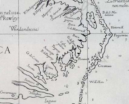
When Captain John Smith and his companions landed at Jamestown, in 1607, the Saponi and Tutelo tribes of Indians, belonging to the Monacan Confederacy of the Siouanº stock, probably had a few small villages in Southwestern Virginia. These tribes were the remnants of the Siouans,º that great stock which once inhabited Virginia "west of a line drawn through Richmond and Fredericksburg, up to the Blue Ridge, or about one-half the area of the State. In North Carolina, the Siouians were spread over the basins of the Roanoke, the Tar, the Cape Fear, the Yadkin, and the upper Catawba rivers, comprising more than two-thirds of the area of that state. In South Carolina, these Indians peopled nearly the whole central and eastern portion. In the three states the territory in question comprises an area of •about 70,000 square miles, formerly occupied by about forty different tribes".1

In prehistoric times, perhaps in the 16th century, the majority of the Siouians abandoned the country and gradually retreated across the mountains to the West, continuing their migration until they crossed the Mississippi River. "The most probable cause of this great exodus was the pressure from the north and from the south of hostile tribes of alien lineage, leaving to the weaker Siouian tribes no alternative but to flee or to remain and be crushed between the millstones."2

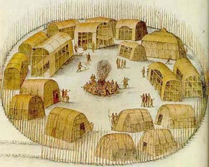
The Iroquoian tribe, the powerful Cherokee nation, succeeded the Siouians in the control of their former territory in Southwest Virginia. The Cherokees, although of Iroquoian stock, were hostile to the northern Iroquois and to the great Southern p502Iroquois tribe, the Tuskaroras, who lived along the Neuse River in North Carolina. The original territory of the Cherokees included "all of North Carolina and Virginia west of the Blue Ridge, as far north at least, according to their tradition, as the Peaks of Otter near the headwaters of the James River, together with the upper portion of South Carolina and the mountain section of Georgia and Tennessee".3 They were driven from the greater portion of their holdings, around 1672, by the northern Iroquois, and settled upon the Savannah River and in the territory south of the Tennessee River. The Cherokees apparently permitted the remnants of the Siouians to live undisturbed in Southwest Virginia, but the Siouians constantly attacked by the northern Iroquois, kept on moving their villages. "Up to 1670 the Monacan (Siouan) tribes had been but little disturbed by the whites, although there is evidence that the wars waged against them by the Iroquois were keeping them constantly shifting about. Their country had not been penetrated, except by a few traders who kept no journals, and only the names of the tribes living on the frontiers of Virginia were known to the whites. Chief among these were the Monacan proper having their village a short distance above (the present) Richmond."4 This settlement was identical with the "Mowhemenchouch" or "Massinacack" found by Newport's expedition, from Jamestown, in 1609. The English, settled on their border (at the falls of the James (Richmond) ), of course were constantly encroaching upon them, and they rapidly wasted away. The English, the Powhatans, and the Iroquois all waged war against them.

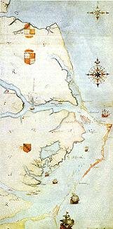
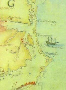
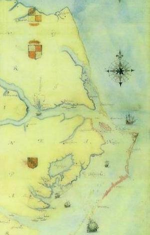
In May, 1670, John Lederer, a German traveler, under commission from the governor of Virginia, explored the country from the settlement at James falls (Richmond) southwestward through Virginia and North Carolina to a village of the Saura, then apparently located on a northern affluent of the Yadkin River, in North Carolina. On the third day, he passed through the Monacan village on the James only twenty miles above the falls. After traveling for days over a rough road, without meeting any Indians or sign of habitation, he arrived at "Sapon", a town of the Nahyssans, probably on the Otter River, southwest of Lynchburg, Virginia. The inhabitants of this village belonged to the Siouian stock, who were called "Tutelo" by the Iroquois. Three days of easy travel carried him •fifty miles southwest of the Siouian village of the Occaneechi, at the junction of the Roanoke and Dan rivers, near Clarksville, Virginia. This village was on a prehistoric path, which ran from Bermuda Hundred, on the James River, to Occaneechi. Thence it passed to the Catawba, Cherokee, p503and other tribes in southwestern North Carolina and northwestern South Carolina, and from the Catawba, via the Cungaree Post, to the present Augusta, Georgia. Its entire length was somewhat over 500 miles. Lederer then struck out to the Southwest, visiting a number of Siouian villages in what is now North Carolina, and afterwards returning to Apamatuck (across from Fort Henry (Petersburg) on the Appomattox River).

The next year (1671) an exploring expedition under Thomas Batts and Robert Fallam, with two Indian guides, left the Appomattox village (now Bermuda Hundred, Virginia), at the mouth of the Appomattox River to discover what lay beyond the mountains. "The three gentlemen bore a commission from Major-General (Abraham) Wood, obtained from Governor Berkeley of Virginia, for the finding out the ebbing and flowing of the Waters on the other side of the Mountains in order to the discoveryº of the South Sea."5

On the fourth day they reached the Sapony or Nahyssan villages, one of which Lederer had visited the year before, on the Otter River, southwest of Lynchburg. They pushed on to a Hanahaskie (Siouian) town; some twenty-five miles west by north, on an island in the Roanoke River. Following up the Roanoke River, they soon came in sight of the mountains (the Blue Ridge). The next day they arrived at the Totero (Tutelo) Indian town, in the vicinity of the present Salem, Virginia. From there they followed the imperial trail up the North Fork of the Roanoke River and crossed the divide somewhere north of Price's Mountain, thus probably passing the future Draper's Meadows on their way to the New River, which they struck, possibly at the mouth of Strouble's Creek, and went down the river a short distance beyond the Narrows at Peter's Mountain, to Union, West Virginia. Here they were compelled to turn back because their Indian guides were "impatient of a longer stay by reason it was like to be bad weather, and that it was so difficult to get provisions".6 They returned to Fort Henry (Petersburg) by the same route they had followed coming out. The journey took 13 days going, and 10 days returning. The distance travelled from the Appomattoc village (Bermuda Hundred) to Union, West Virginia, where they turned back, was •about three hundred and sixty miles, making the round trip approximately 720 miles.

This expedition was probably the first one to reach the New River, although "cropping out in all the literature of the Mississippi Valley exploration from the eighteenth century to the monographs of contemporary scholars, is the bare statement, p504now calmly presented as a fact, now contemptuously mentioned as a lie, that in the year 1654 or at various times in the decade following that year Abraham Wood (who commissioned the Batts and Fallam expedition) gained the banks of the Ohio, or of the Mississippi, or both. It can probably never be either proved or disproved with absolute certainty, but long and patient search has yielded the facts about to be recited, and only these . . . Dr. Daniel Coxe was the first to mention the episode. His account appears in a memorial to King William, presented to the Board of Trade November 16, 1699, and, in the younger Coxe's book 'Carolina'. Coxe states that at several times during the decade 1654‑1664 Wood discovered several branches of the great rivers Ohio and Meschabe (Mississippi). In confirmation, Coxe alleges that he was at one time in possession of a journal of a Mr. Needham, one of the agents Wood employed in his exploring expeditions. Now Wood's men did discover branches of the Ohio and Mississippi, in the years 1671‑74; and the Needham referred to was employed in the most brilliant of these discoveries (that of the Tennessee River, in 1673). Since Coxe states incorrectly both Wood's title and place of residence, it is most probable that his information about the date was also incorrect. It would seem that subsequent writers have simply followed Coxe, either at first or second hand . . . The whole tone of Fallam's journal and of Wood's letter regarding the explorations of 1673‑74, and especially Wood's references in that letter to the discoveries of Batts and Fallam, in 1671, make it reasonably certain that Wood had not been on the western waters at any prior time."7

Soon after 1701, the Siouians, constantly attacked by the northern Iroquois (the Cherokees did not disturb the Siouians), began to group together in a large tribe, first making a settlement, called "Sapona Town", a short distance east of the Roanoke River and about 15 miles westward from the present Windsor, in Bertie County, North Carolina, and finally, in 1711, locating near Fort Christanna, about the site of the Gholsonville, Brunswick County, Virginia, of to‑day. This by permission of Governor Spotswood. About 1740, having made peace with the northern Iroquois, the last of the Virginian Siouians, the remaining members of the Tutelo and Saponi tribes, went north, stopping for a time at the Indian village of Shamokin (Sunbury), Pennsylvania. In 1753, the Cayuga Indians, living near Ithaca, New York, formally adopted the Siouians, who then became part of the Six Nations — the Iroquois.

With the departure of the last of the tribes of the Siouians from Southwest Virginia, in 1711, the region was probably cleared p505 of all Indian settlements. The entire great valley was disputed Indian territory, both the Cherokees and Shawnees holding it as their hunting ground.

William and Mary Quarterly
2nd Ser., Vol. 17 No. 4 (Oct. 1937), pp501‑513

the text of which is in the public domain

Sunday, August 17, 2008

Lumbee Surnames: Who Knew There Were So Many?

Artwork by Hatty Ruth Miller, Lumbee  artist
Genealogical materials

BRIT004. Britt, Morris F. "Appendix T. List of Lumbee surnames with dates of appearance in the greater Lumbee Settlement (N=523 surnames) 1740-2007." 107 pages. Key source Key source

Publication type: Unpublished manuscript (appendix to forthcoming book)

Full text: PDF files of sections of the manuscript can be downloaded from the table below.

Morris F. Britt has been compiling Lumbee surnames since 1986 (see his "Indian names in Robeson County," Robeson County Register 1.3 (August 1986): 113; item 1027). He began thinking there were about a dozen names; then, in examining the 1990 federal census for Robeson County, he found that there were 120. He went on to study the 1910 federal census for Robeson County (see his "Robeson County Indian names: An analysis based upon the Census of 1910," Robeson County Register 6.3 (1991): 120-122; item 1039). He continued compiling surnames as part of his research for a forthcoming book on Lumbee origins. Once he recorded additional names discovered by Jane Blanks Barnhill for her book of Lumbee cemetery records, Sacred Grounds: "Gone but Not Forgotten" (see item BARN002), his list had grown to 523 documented surnames and—with his detailed recounting of the sources in which he found each name—107 pages.

In his preface to this list, Britt explains that he has included "not only the most frequent, prominent 'core' Lumbee surnames but all such names, however infrequent, ever identified in the Settlement from the 1740s to the present" (p. 3). He also lists the sources from which he derived the names: "land and tax records, cemetery records, death certificates, census reports, wills, deeds, petitions for acknowledgment, military and church records, and newspaper notices" (p. 3).

Britt offers important advice to researchers in his preface. To summarize: (1) many names in Robeson County can be Lumbee, White, African American, or all three; thus, a surname alone does not guarantee Lumbee ancestry. (2) Lumbee ancestors have been listed with a wide range of designations in historical records, including Mulatto, free persons not White, and free persons of color. In early Robeson and Bladen County census records and tax lists, the designation Indian appeared only once (in a 1768 Bladen tax list). Therefore, Britt says, "As a cautionary note, you cannot take any single-entry racial designation, White, African-American, or Indian, 'as gospel' " (p. 2).

Britt provides this list of surnames—in advance of the publication of his book—as an aid to researchers. It should prove especially valuable to those seeking enrollment in the Lumbee Tribe. In his documentation of the sources in which he found each Lumbee surname, Britt notes whenever the surname was "self-identified as Indian in the 1900 federal census of Robeson County." He also notes whenever a surname is included in Carol Smith Oxendine's 1982 document, 1900 Federal Census information of Indians of Robeson County (see item 1023). Smith's document lists both people self-identified as Indian in the census and those verified as Indian through research. When referring to this document, Britt uses these phrases: "1900 Robeson County Indian Census schedule," "1900 Indian Census Schedule," or "1900 Indian Census Schedule of Robeson County." One of the Lumbee Tribe's requirements for enrollment is tracing ancestry back to people listed as Indian in the 1900 federal census of Robeson County.

Because of the length of this document, it has been divided into ten parts. All researchers should download and read Part 1, which includes Britt's preface explaining how the list was compiled and offering advice to researchers. The table below shows the first and last surname included in each part of the document.

List of Lumbee surnames with dates of appearance in the greater Lumbee Settlement (N=523 surnames) 1740-2007

Part 1 Title page, introduction, Adams—Alford
Part 2 Alford —Braveboy/Braboy / Brayboy / Braceboy
Part 3 Braveboy / Braboy / Brayboy / Braceboy—Carsey
Part 4 Carter—Davis
Part 5 Davis—Groom
Part 6 Groom—Knights
Part 7 Kober—Mitchell
Part 8 Mitchell—Quick
Part 9 Quinto—Sweat / Sweet
Part 10 Sweeting—Young (end)

Home Page URL: lumbeebibliography.net

This page was updated on May 7, 2008 1:18 PM


Copyright © 2007, Glenn Ellen Starr Stilling. This document may be reproduced only if this copyright notice is reproduced with it.

Friday, August 15, 2008

Summer Sizzling Sale at Family Tree DNA


Just received from Family Tree DNA. These prices are unbelievable. I hope everyone will take advantage of them.

===================================================================

Dear Group Administrator,

In June, Family Tree DNA ran our most successful promotion ever, in which we offered a significant discount on many of our test upgrades.

Now that our lab has had time to process the high volume of orders generated by that promotion, we are ready to challenge the record that we set in June by returning to you with our “Sizzling Summer Sale.” This time, the promotion is geared towards bringing new members to your projects by offering the following big incentives:

Y-DNA12 orders include a FREE mtDNA test (Y-DNA12+mtDNA promotion price of $99; normally $189)
Y-DNA25 orders include a FREE mtDNA test (Y-DNA25+mtDNA promotion price of $148; normally $238)
Y-DNA37 orders price REDUCED to $119 (normally $189)
Y-DNA37+mtDNAPlus orders price REDUCED to $189 (normally $339)
Y-DNA67+mtDNAPlus orders price REDUCED to $288 (normally $409)
mtDNAPlus price REDUCED to $149 (normally $189)

This promotion goes into effect immediately and will be available until August 31st, 11:59PM CST.

We would also like to make you aware of a change in shipping costs. Since our inception we never increased our shipping charge, even though in the meantime USPS has increased its rates 6 times. For that reason, our shipping cost will increase by $2, effective immediately. We appreciate your understanding.

As always, thank you for your continued support!

Family Tree DNA
Best Regards


Bennett Greenspan
President

Thursday, August 14, 2008

The Lost Colony's Reaching for the Stars Production is Born for Broadway


Broadway comes to the beach when The Lost Colony presents Reaching for the Stars: The Joy of Broadway — a spectacle of song and dance at 8:15 p.m. on Saturday Aug. 16 at Waterside Theatre in Manteo.

Reaching for the Stars promises "a fantastic good time," according to the production's director Greg London, "you can experience things you wouldn't—unless you were in New York City!"

Without a bothersome airplane trip to the Big Apple, guests are guaranteed a good time, enjoying enduring and current Broadway hits from: Mary Poppins, My Fair Lady, The Wiz, Chorus Line, Thoroughly Modern Millie, South Pacific, Cabaret, Hairspray and other performed by the gifted Lost Colony cast and crew. Songs from The Lost Colony's upcoming 2009 productions of Jesus Christ Superstar and Oklahoma will also be featured. Most of the musical numbers in Reaching for the Stars are Tony award-winning hits.

The Lost Colony Company is known for their exceptional talent.

Derek Keeling, a 2001 alum, is now appearing as Danny in Grease on Broadway. Over the years, many Lost Colony alumni performers have appeared on Broadway, and if the 2008 company follows suit, they too are Broadway bound—all the more reason to attend this performance.

Wednesday, August 13, 2008

Lost Colony: New clues, old mystery Recently recovered artifacts being identified

Wednesday August 13, 2008

The artifacts from the May 2008 archaeological excavations at Fort Raleigh National Historic Site have been researched and verified.

According to an interim report submitted to the National Park Service by Phillip Evans, Eric Klingelhofer, Nick Luccketti, and Clay Swindell, all of the First Colony Foundation (FCF), hundreds of the discoveries date back to the era of The Lost Colony.

The project was initially planned to excavate two areas where anomalies had previously been detected by ground penetrating radar surveys. The two areas contained rectangular shaped objects, which according to the report, "do not normally occur in nature, it is presumed that the anomalies are cultural in origin and could possibly be structures or features associated with the original colony."

Working with Time Team USA, an American version of the BBC archaeological series broadcasted since 1994, FCF began their twelve day excavation. Time Team USA excavated for three of the twelve days, bringing together multiple specialists and a film crew to document the project.

There were numerous findings during the excavation, including copper plates and 215 Native American pottery sherds. The sherds verified to date are separated into three series: Colington series, Cashie series, and Untyped fine sand tempered series.

As described in the report, the Colington phase covers the Late Woodland period in the Albemarle region. The material is affiliated with those that formed the chiefdoms and were visited and described by the English explorers in the 1580s. The shell tempered ceramics vary little through time and house an unusual display of decorative designs.

Also included in the Colington phase are motif engraved ceramic smoking pipes, bone/shell tools, marine shell/stone, copper, beads, ornaments, and pendants. There were a total of 208 Colington series artifacts discovered during the excavation.

Tuesday, August 12, 2008

Happy 428th Birthday, Virginia Dare!!!

Virginia Dare (born August 18, 1587, date of death unknown) was the first child born in the Americas to English parents, Eleanor (or Ellinor/Elyonor) and Ananias Dare. She was born into the short-lived Roanoke Colony on Roanoke Island in present-day North Carolina, USA. What became of Virginia and the other colonists has become an enduring mystery. The fact of her birth is known because the leader of the colony, Eleanor Dare's father, John White, returned to England to seek assistance for the colony. When White returned three years later, the colonists were gone.

Historical explanations

John Smith and other members of the Jamestown Colony sought information about the fate of the colonists in 1607. One report indicated that the Lost Colonists took refuge with friendly Chesapeake Indians, but Chief Powhatan claimed his tribe had attacked the group and killed most of the colonists. Powhatan showed Smith certain artifacts he said had belonged to the colonists, including a musket barrel and a brass mortar. The Jamestown Colony received reports of some survivors of the Lost Colony and sent out search parties, but none were successful. Eventually they determined they were all dead.[1]
However, in her 2000 book Roanoke: Solving the Mystery of the Lost Colony, historian Lee Miller postulated that some of the Lost Colony survivors sought shelter with a neighboring Indian tribe, the Chowanoc, that was attacked by another tribe, identified by the Jamestown Colony as the "Mandoag," but who Miller thinks were actually the Eno, also known as the Wainoke. Survivors were eventually sold into slavery and held captive by differing bands of the Eno tribe, who, Miller wrote, were known slave traders. Miller wrote that English settlers with the Jamestown Colony heard reports in 1609 of the captive Englishmen, but the reports were suppressed because they had no way to rescue the captives and didn't want to panic the Jamestown colonists. William Strachey, a secretary of the Jamestown Colony, wrote in his The History of Travel Into Virginia Britania in 1612 that, at the Indian settlements of Peccarecanick and Ochanahoen, there were reportedly two-story houses with stone walls. The Indians supposedly learned how to build them from the Roanoake settlers.[2] There were also reported sightings of European captives at various Indian settlements during the same time period.[3] Strachey wrote in 1612 that four English men, two boys, and one maid had been sighted at the Eno settlement of Ritanoc, under the protection of a chief called Eyanoco. The captives were forced to beat copper. The captives, he reported, had escaped the attack on the other colonists and fled up the Chaonoke river, the present-day Chowan River in Bertie County, North Carolina.[4][2][5] For four hundred years, various authors have speculated that the captive girl was Virginia Dare. When White left the colony in 1587, there were eighty-seven men, seventeen women and eleven children among the colonists. Virginia Dare was one of two infants born to colonists in 1587 and was the only female child in the Lost Colony.


Possible descendants

The Chowanoc tribe was eventually absorbed into the Tuscarora. The Eno tribe was also associated with the Shakori tribe and was later absorbed by the Catawba or the Saponi tribes. Today one group is known as the Haliwa-Saponi tribe. From the early 1600s to the middle 1700s European colonists reported encounters with gray-eyed American Indians or with Welsh-speaking Indians who claimed descent from the colonists.[6][7] In 1669 a Welsh cleric named Morgan Jones was taken captive by the Tuscarora. He feared for his life, but a visiting Doeg Indian war captain spoke to him in Welsh and assured him that he would not be killed. The Doeg warrior ransomed Jones and his party and Jones remained with their tribe for months as a preacher.[6] In 1701, surveyor John Lawson encountered members of the Hatteras tribe living on Roanoke Island who claimed some of their ancestors were white people. Lawson wrote that several of the Hatteras tribesmen had gray eyes.[7] Some present-day American Indian tribes in North Carolina and South Carolina, among them the Coree and the Lumbee tribes, also claim partial descent from surviving Roanoke colonists. A non-profit organization, the Lost Colony of Roanoke DNA Project, has launched a Lost Colony DNA Project to test possible descendants.
Copyright (c) 2008 History Chasers
Permission is granted to copy, distribute and/or modify this document
under the terms of the GNU Free Documentation License, Version 1.2
or any later version published by the Free Software Foundation;
with no Invariant Sections, no Front-Cover Texts, and no Back-Cover Texts.
A copy of the license is included in the section entitled "GNU
Free Documentation License".
http://en.wikipedia.org/wiki/Wikipedia:Text_of_the_GNU_Free_Documentation_License


Monday, August 11, 2008

From the Ashes; a Golden Opportunity

From disaster to opportunity

Broadway costume designer rebuilds 'Lost Colony' wardrobe

William Ivey Long has been called the busiest costume designer on Broadway with a career that spans more than 50 shows. But a tragic event hundreds of miles away from New York made this past year his busiest ever.

In September 2007, an early morning fire swept through the home of "The Lost Colony" on Roanoke Island, N.C., destroying more than 5,000 costumes that had been assembled over the show's 71-year history. Long grew up in the summertime world, and in many ways, he never left it. He maintains a home there, and for many years, has served as set and costume designer for the long-running outdoor drama.

"I remember great sadness and shock," says Long, recalling when he first heard about the fire. "It took me two months to realize that this was an opportunity instead of a disaster."

The "opportunity" meant a chance to redesign the show's entire sweep of costumes from a historical perspective using newly available research. Long canceled commitments on two Broadway shows to work on the "The Lost Colony" project. He and his 60-person staff worked in New York and at the North Carolina theater to build the 1,000 costumes needed for the show. Some funds came from state and federal park services, but the majority of the $2.7 million needed to reconstruct sets, costumes and stage buildings came from individuals.

Long has been associated with "The Lost Colony" almost since the day he was born. His father, William Long Sr., held many jobs there, including technical director from 1949 to 1962. His mother, Mary Wood Long, worked in the costume shop while playing several onstage roles, including the part of Queen Elizabeth I from 1949 to 1953. During his early childhood, Long recalls sleeping in fabric bins underneath the cutting tables of the costume shop.

Continued here:

http://www.dailypress.com/features/dp-gl_williamiveylong_0810aug10,0,962645.story

John White, A Festive Dance

John White, A Festive Dance


North America

Around AD 1585-93

In 1585, John White and a group of English settlers sponsored by Sir Walter Raleigh arrived on the east coast of North America to found new colonies. White had some artistic training and his duties included making visual records of anything unknown in England, including plants, animals, birds and the inhabitants, especially their costumes, weapons and ceremonies. In the area around Roanoke and the tidewaters of coastal North Carolina they found people who called themselves Secotan, who in mid-July held a green corn or harvest ritual, with ceremonies like the one recorded here. This may be the Green Corn or Harvest Festival, celebrating the first harvest of Indian corn or maize at the end of the summer.

cont. here:

http://www.britishmuseum.org/explore/highlights/highlight_objects/pd/j/john_white,_a_festive_dance.aspx

Friday, August 8, 2008

Virginia Dare Birthday Celebration


Virginia Dare Birthday Celebration
Fort Raleigh National Historic Site Visitor Center
US 64/264, Roanoke Island
(252) 473-2127

This event, held August 18, commemorates the birth of Virginia Dare, the first English child born in the New World. The celebration features a day long series of special happenings. Past events featured performances by members of the cast of The Lost Colony and demonstrations of arms from that period in history. Call the National Park Service for details. This event is free. The Elizabethan Gardens, right next to Fort Raleigh, honors Virginia Dare's birthday by offering free admission to the gardens on this day and a free play about Queen Elizabeth and Sir Walter Raleigh.

The Lost Colony DNA Project will be represented at the Virginia Dare Faire on her birthday, August 18th, at Fort Raleigh on Manteo, which is also the last night for the Lost Colony production for the season. We were there last year as well and talked to a great number of people about our project, the Lost Colony and DNA. Several staff members will be on hand to visit with guests during the afternoon and will be located at the brand new Costume Shop.

Please stop by and visit if you can!

Friday, August 1, 2008

Rumors of the Lost Colony in Jamestown, UNC School of Education


William Strachey, first secretary of the Jamestown colony, wrote a history of that colony in 1612. In it, he mentioned several rumors about the fate of the colonists who had disappeared from Roanoke twenty years before.

Here Strachey explains the colonists’ attitudes toward the Indians, which are fortified by what they believe happened to their predecessors at Roanoke.

For the apter enabling of our selfes unto which so heavenly an enterprise, who will thinck yt an unlawfull act to fortefie and strengthen our selves (as nature requires) with the best helpes, and by sitting downe with guardes and forces about us in the wast and vast unhabited growndes of their[s], amongst a world of which not one foote of a thousand doe they either use, or knowe howe to turne to any benefitt; and therfore lyes so great a circuit vayne and idle before them? Nor is this any injurye unto them, from whome we will not forceably take of their provision and labours, nor make rape of what they dense and manure; but prepare and breake up newe growndes, and therby open unto them likewise a newe waye of thrift or husbandry; for as a righteous man (according to Solomon) ought to regard the lief of his beast, so surely Christian men should not shew themselves like wolves to devoure, who cannot forget that every soule which God hath sealed for himself he hath done yt with the print of charity and compassion; and therefore even every foote of land which we shall take unto our use, we will bargaine and buy of them, for copper, hatchetts, and such like comodityes, for which they will even sell themselves, and with which they can purchace double that quantity from their neighbours; and thus we will commune and entreate with them, truck, and barter, our commodityes for theires, and theires for ours (of which they seeme more faine) in all love and freindship, untill, for our good purposes towards them, we shall finde them practize violence or treason against us (as they have done to our other colony at Roanoak): when then, I would gladly knowe (of such who presume to knowe all things), whether we maye stand upon our owne innocency or no, or hold yt a scruple in humanitye, or any breach of charity (to prevent our owne throats from the cutting), to drawe our swordes, et vim vi repellere? (pp. 19–20)


Seven colonists, including a “young mayde,” apparently escaped the slaughter. The maid may have made a further escape.

This high land is, in all likelyhoodes, a pleasant tract, and the mowld fruictfull, especially what may lye to the soward; where, at Peccarecamek and Ochanahoen, by the relation of Machumps, the people have howses built with stone walles, and one story above another, so taught them by those Englishe whoe escaped the slaughter at Roanoak, at what tyme this our colony, under the conduct of Capt. Newport, landed within the Chesapeake Bay, where the people breed up tame turkeis about their howses, and take apes in the mountaines, and where, at Ritanoe, the Weroance Eyanoco preserved seven of the English alive — fower men, two boyes, and one yonge mayde (who escaped and fled up the river of Chanoke [Chowan]), to beat his copper, of which he hath certaine mynes at the said Ritanoe, as also at Pamawauk are said to be store of salt stones. (p. 26)


Strachey explains what happened to the colonists after they left Roanoke.

[H]is majestie [James I] hath bene acquainted, that the men, women, and childrene of the first plantation at Roanoak were by practize and comaundement of Powhatan (he himself perswaded therunto by his priests) miserably slaughtered, without any offence given him either by the first planted (who twenty and od yeares had peaceably lyved intermixt with those salvages, and were out of his territory) or by those who nowe are come to inhabite some parte of his desarte lands, and to trade with him for some comodityes of ours, which he and his people stand in want of; notwithstanding, because his majestie is, of all the world, the most just and the most mercifull prince, he hath given order that Powhatan himself, with the weroances and all the people, shalbe spared, and revenge only taken upon his Quiyoughquisocks, by whose advise and perswasions was exercised that bloudy cruelty… (pp. 85–86)

continue here

American Indian town of Pomeiooc

Black and white drawing of the American Indian town of Pomeiooc.  The town consists of several buildings surrounded by a fence.  In the center several people sit and stand around a fire.
Engraving of the American Indian town of Pomeiooc, published in Thomas Hariot's 1588 book A Briefe and True Report of the New Found Land of Virginia. (Illustration by Theodor de Bry. More about the illustration)


The towns of this country are in a manner like unto those which are in Florida, yet are they not so strong nor yet preserved with so great care. They are compassed about with poles stark fast in the ground, but they are not very strong. The entrance is very narrow as may be seen by this picture, which is made according to the form of the town of Pomeiooc. There are but few houses therein, save those which belong to the king and his nobles. On the one side is their temple separated from the other houses, and marked with the letter A. It is built round, and covered with skin mats, and as it were compassed about with curtains without windows, and has no light but by the door. On the other side is the king’s lodging marked with the letter B. Their dwellings are built with certain potes [sticks] fastened together, and covered with mats which they turn up as high as they think good, and so receive in the light and other. Some are also covered with boughs of trees, as every man lusts or likes best. They keep their feasts and make good cheer together in the middle of the town as it is described in the 17 figure. When the town stands far from the water they dig a great pond noted with the letter C where hence they fetch as much water as they need.


“The Towne of Pomeiooc.” Theodor de Bry’s engraving of the American Indian town of Pomeiooc, published in Thomas Hariot’s 1588 book A Briefe and True Report of the New Found Land of Virginia.