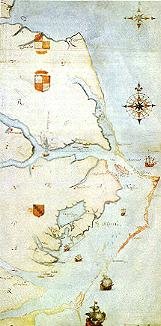
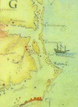
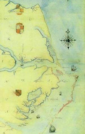
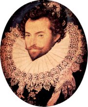
If Hernando de Soto and Juan Pardo had been successful and established a series of permanent settlements, we might all be speaking Spanish in this country rather than English. That’s one conclusion that archeologist Rob Beck of the University of Oklahoma likes to tell people about when he describes the discovery of Fort San Juan on the upper Catawba River in Burke County north of Morganton.That fort was established by de Soto’s men in 1567 – a couple of decades before Sir Walter Raleigh’s expedition set out from England and established a colony on Roanoke Island that disappeared – and became known as the Lost Colony.
The Fort San Juan story is told in a new episode of UNC-TV’s “Exploring North Carolina” series produced by narrator Tom Earnhardt of Raleigh and videographer Joe Albea of Greenville. It airs tonight at 8:30 p.m. and repeats Friday, Feb. 1 at 9:30 p.m. and Sunday, Feb. 3 at 6 p.m.The program describes how Beck and other archeologists, including David Moore of Warren Wilson College near Asheville and Christopher Rodning of Tulane, assembled the evidence that linked the 12-acre site in Burke County to a known site at Parris Island. S.C., where Spanish explorers established a fort in what then was called northern Florida.
Continued here:
http://jackbetts.blogspot.com/2008/01/was-first-lost-colony-in-burke-county.html
Thursday, January 31, 2008
De Soto's Fort Located?

Tuesday, January 29, 2008
Lost Colony Dig; Probing the Past with Radar
BY ED BECKLEY | SENTINEL CORRESPONDENT
When doctors want to see a body's organs they use an magnetic resonance imaging machine (MRI) to view beautifully clear images of what's inside.
When archaeologists want to see what's below the surface of the earth they are now beginning to use a similar technology called computer-assisted radar tomography (CART).
An archaeologist with the First Colony Foundation was on site at Fort Raleigh Saturday with CART engineers testing the advanced ground penetrating system. Their hope is that CART will prove to be a viable tool to help find artifacts from Sir Walter Raleigh's 16th Century colonies in the future.
The First Colony Foundation comprises a team of top archaeologists who in recent years discovered the expanded Jamestown, Va. settlement. The group also is a partner with the National Park Service in search of the Elizabethan presence on Roanoke Island. It has dug its share of holes along Roanoke Sound the past couple of years.
http://obsentinel.womacknewspapers.com/articles/2008/01/23/top_stories/tops3441.txt
Monday, January 28, 2008
Search for Lost Colony takes a high-tech turn
By Catherine Kozak
The Virginian-Pilot©
January 28, 2008
An innocuous-looking golf course tractor pushing a platform on wheels could help illustrate the nation's oldest mystery.
In the quest for the Lost Colony, the vanished 1587 English settlement on Roanoke Island, archaeologists have conducted numerous explorations in Fort Raleigh National Historic Site, digging and surveying and scanning and scoping.
But they've never used high-tech radar tomography that can produce 3-D images out of data collected from 6 feet, more or less, under ground.
The refined technology, which can also use sound and light waves, gained early fame when inventor Alan Witten used it to help locate fossils from a 120-foot-long dinosaur - called "seismosaur us " - in the late 1980s in New Mexico. The find was fictionalized in Michael Crichton's "Jurassic Park."
"This is fantastic, cutting-edge technology," said Eric Klingelhofer, vice president of the First Colony Foundation, in a telephone interview. "I am eager to see the findings and then compare them with what we know of the archaeology of the site."
On a recent, rainy Saturday morning, Klingelhofer, who is a professor at Mercer University in Georgia, watched as a contractor with Witten Technologies drove the tractor back and forth in the parking lot and grass borders near the ticket booth at Waterside Theatre, where "The Lost Colony" outdoor drama is performed each summer.
"We're picking up the utilities, which is good, because that's what the equipment is designed to do," he said. "But we have picked up some anomalies, which is good."
The veteran archaeologist said the foundation, which has an agreement with the National Park Service to do archaeological investigations at the park, dug on the sound side of the parking lot in 2006. And in the 1990s, archaeologists dug between the earthworks and the theater. The hope, he said, is that Witten's technology, which is costing a couple of thousand dollars, can help pinpoint where significant anomalies, or irregularities, are located before the archaeologists touch a shovel.
http://hamptonroads.com/2008/01/search-lost-colony-takes-hightech-turn
Sunday, January 27, 2008
Graveyard of the Atlantic

You can stand on Cape Point at Hatteras on a stormy day and watch two oceans come together in an awesome display of savage fury; for there at the Point the northbound Gulf Stream and the cold currents coming down from the Arctic run head-on into each other, tossing their spumy spray a hundred feet or better into the air and dropping sand and shells and sea life at the point of impact.
Tuesday, January 22, 2008
Occaneechi Indians
John Lawson, who visited the Occaneechi in 1701, gives us what is probably our latest, best known view of how the Occaneechi were living prior to their incorporation with the Saponi. Coupling Lawson's (Lefler 1967) written account with the information gained by recent excavations at Occaneechi Town by the Research Laboratories of Anthropology (Dickens et al. 1987; Ward and Davis 1988), it is possible to gain a fairly clear picture of a society undergoing rapid change, and yet endeavoring to maintain some semblance of a traditional lifestyle. In a period of time when small fragmented groups across the Piedmont were banding together for mutual assistance and protection, the merging of families and small tribes at Occaneechi Town would not have been unusual.
Occaneechi Town was almost completely abandoned by 1713, when the Occaneechi signed a Treaty of Peace with the Virginia colonial government at Williamsburg. At that point, it is indicated from reading the document that the Occaneechi, Stuckanok, and Tottero, although signing the treaty separately, were dominated by the Saponi. At least, the whites seemed to regard them all as Saponi. Governor Spotswood of Virginia would later refer to the Fort Christanna Indians as all going under the name of Saponi. There are very few references to the Occaneechi as a distinct tribe after the settlement at Fort Christanna, which operated from 1714 to 1717.
After the Indians were settled on the Meherrin River near present-day Lawrenceville, Virginia, a school and minister were provided for their instruction, along with a small company of rangers who were to guard the eastern colonists from attacks by western tribes such as the Cherokee. Once they were "civilized" by the influences of Christianity and the English language, the Saponi were no doubt expected to assist in this duty. The fort also served as a trading center for the Indian trade, but the profits apparently were not great enough to satisfy the project's backers and the fort was closed in 1717.
http://www.ibiblio.org/dig/html/split/report47b.html
Monday, January 21, 2008
Roanoke, the Accidental Colony

The Lost Colony, an accident of fate with a tragic outcome that reverberates to this day, should never have happened. The group of colonists sent out by Sir Walter Raleigh in 1587 to establish the Cittee of Raleigh, had never intended to locate on the Island of Roanoke. But after a four month long trip marked by delays, mishaps, evasive tactics and possibly outright sabotage, these some 117 men, women and children were unceremoniously dumped on the island by Captain Fernandez. All but but two of them would vanish without a trace.
Sunday, January 20, 2008
THE INDIANS OF PERSON COUNTY NORTH CAROLINA
Newspaper Article - 1948
THE INDIANS OF PERSON COUNTY NORTH CAROLINA
HISTORY OF A PROUD AND HANDSOME TRIBE OF INDIANS NEAR ROXBORO MAY BE CONNECTED WITH LOST COLONY MYSTERY; ABOUT 70 FAMILIES LIVE IN EXTENDED FARMING COMMUNITY
By Tom MacCaughelty
Durham Morning Herald, March 21, 1948
Straddling the North Carolina border in the secluded hills east of U.S. Highway 501 is a community of American Indians whose history has remained as much a mystery as the fate of the Lost Colony. Commonly termed a "mixed-blood" group, these proud people are probably the product of marriages long ago of whites and Indians, and, in fact, have a tradition among themselves which says they are remnants of the Lost Colony. In color they vary between blondes and even red-heads with grey or blue-gray eyes to tawny and sometimes swarthy brunettes with hazel, brown, or black eyes. Some have the straight black hair associated with pure Indian, while others have differing shades of brown hair, either straight or wavy. In general appearance they are well- dressed and clean. They are a handsome people. Their history is mysterious. As Indians, they never have been positively identified. Can they be, as their tradition holds, the long sought descendants of the friendly Indians who received the colonists of John White? Strangely enough, among the approximately 350 people in the scattered farming community, only six family names are represented: Johnson, Martin, Coleman, Epps, Stewart (also spelled Stuart), and Shepherd. Stranger still, three of these names correspond closely with those among the list of Lost Colonists: Johnson, Coleman, and Martyn. But theirs are common English names long familiar in North Carolina, and intermarriage with the proximity to whites would be expected to extend such names among them. (A seventh prominent name among this group is Tally.) As far back as anyone knows, these people have displayed the manners and customs of white settlers, but in this they don't differ from identified Indians.
Unfortunately, as far as settling the question goes, not a single Indian word had been passed down to the present group. If their former manner of speech could somehow be resurrected, there would be a good clue to their identity; for then experts could judge with some degree of accuracy whether they indeed originated among the coastal Algonquin language tribes. If so, there would be a good argument for the Lost Colony theory. If their language were Siouan or some other branch of the inland tongues, the score would be against the Lost Colony tradition.
Dr. Douglas LeTell Rights, author of "The American Indian in North Carolina," (published by Duke University Press in 1947) says that there is a possibility that the people, officially designated as Person County Indians, are descendants of the Saponi, originally a Siouan tribe. He notes that Governor Dobbs reported in 1755 that 14 men and 14 women of the Saponi were in Granville county. Person County was once a part of Granville county. ( Dr. Rights also suggests that these Indians in Person County may be a branch of, or have mixed with, the Indians of Robeson County. The people themselves deny being a branch of the Robeson County Indian, but say that there have been a few marriages between members of the two groups.)
The Person County Indians, if they are of the Saponi, couldn't choose a more highly regarded tribe. (Col. William Byrd, in his History of The Dividing Line describes this tribe.) Whether a remnant of the Lost Colony, or of the proud Saponi, or of some other group, these people have lived in the rolling hills and high plains northeast of Roxboro for countless generations. No one knows how long. According to E. L. Wehrenberg, for 17 years principal of the community school, it was not until 1920 that they were officially recognized by act of the North Carolina legislature as Person County Indians. Before that, however, they had always insisted upon being treated either as Indians or whites. Back in the days of subscription schools, they hired their own white teachers; and under the present county school system have always had white or Indian teachers. Wehrenberg estimates that there are about 70 families in the group. and that about two-thirds of the people live in Person County and the rest across the line in Virginia. This proportion has changed from time to time he says.
Friday, January 18, 2008
Roanoke Island Festival Park attendance up 21 percent

Executive Director Scott Stroh recently announced a 21 percent increase in attendance at Roanoke Island Festival Park for 2007, completing the year with just under 150,000 visitors.
"I am thrilled with our growth and very proud of our staff's tremendous work. Our mission is to involve residents and visitors of all ages in a creative and stimulating exploration of Roanoke Island's historical, cultural, and natural resources and being able to successfully realize this goal with ever increasing numbers of guests is very rewarding for all of us at the Park," said Stroh.
With the commencement of the Exhibit Enhancement Project, 2008 will be another year of growth for the Park. This project includes the creation of an outdoor, interactive American Indian Town and Cultural Educational Center, the re-design of the Park's Visitor Center and placement of site-wide way-finding signage, and the expansion of exhibits in the Roanoke Adventure Museum.
In addition, the State of NC has recently awarded $1 million in improvements to the Outdoor Pavilion. Work will include raising and extending the stage, raising the existing roof, lighting enhancements, updating dressing rooms and restrooms and more. "We are very fortunate to have received significant funds in support of the Park's enhancement and growth. The projects currently underway will dramatically improve the guest experience at the Park and better enable us to meet important needs in our community," said Stroh.
Roanoke Island Festival Park is an interactive family attraction that celebrates the first English settlement in America. The centerpiece of the 25-acre island park is Elizabeth II, a representation of one of seven English ships from the Roanoke Voyage of 1585.
Full Article Here:
http://obsentinel.womacknewspapers.com/articles/2008/01/16/business/bus354.txt
Thursday, January 17, 2008
Virginia Indian Tribes
Part 2
Pamunkey Tribe
The Pamunkey tribe was one of the largest in the Powhatan paramount chiefdom . The tribe is now based in King William County on the Pamunkey Indian Reservation on the banks of the Pamunkey River. This 1,200-acre reservation is part of land awarded to the Pamunkey in the 17th century. The reservation lands were confirmed as part of the Articles of Peace, a 1677 treaty with the King of England which remains the most important existing document describing Virginia’s historic stance regarding Indian lands. Research on the reservation indicates evidence of Native occupation going back 10,000 – 12,000 years. Pamunkey tribal members continue the traditions of pottery making, fishing, hunting, and trapping. Like the Mattaponi, the Pamunkey place an emphasis on the importance of the shad in the river adjacent to their reservation, and they maintain a shad hatchery to ensure the continuation of the healthy shad runs in the Pamunkey River.
Wednesday, January 16, 2008
Virginia Indian Tribes
Part 1
The Chickahominy Indian Tribe, whose name has been translated as “course ground corn people,” was officially recognized by the Commonwealth of Virginia General Assembly on March 25, 1983. With approximately 875 Chickahominy people living in the vicinity of the Tribal Center, the Chickahominy are based in Charles City County near the many towns along the Chickahominy River where the tribe lived in 1600. The Chickahominy had early contact with the English settlers because of their proximity to Jamestown, and they taught early colonists how to survive by growing and preserving their own food. As the English prospered and claimed more land, the Chickahominy tribe was forced out of their homeland. The treaty of 1646 awarded reservation land to the Chickahominy and other tribes in the “Pamunkey Neck” area of Virginia where the Mattaponi reservation exists todays. After 1718, they were forced off this reservation, and over the ensuing years Chickahominy families moved to Chickahominy Ridge in present day Charles City County where they now reside. Here the tribe purchased land and established the Samaria Baptist Church, which remains an important focal point for the community.
The Chickahominy Indian Eastern Division (CIED) also originated with the historic Chickahominy tribe. This tribe, based in New Kent County, was established in the early 20th century and has approximately 130 members today. Their members established the Tsena Commocko Baptist Church, and in recent years have purchased approximately 40 acres as tribally held land.