

July 9, 2010
Lots of work is going on behind the scenes. What did we ever do without e-mail and how did we collaborate on a project spanning two continents, three countries and many states, counties and provinces? Maybe the answer is that projects of this magnitude were handled differently, not at all, or proceeded much more slowly. Recently Andy and Baylus have been working together on the geography of the Outer Banks island chain. Come ride along with Baylus on their journey of discovery!!
Rediscovering The False Cape
By Baylus Brooks
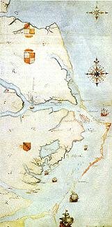
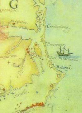
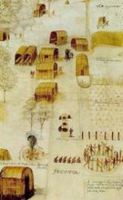
Ever since Andy Powell emailed about the “false cape” in the area of Rodanthe on the Outer Banks it has been bugging me about the current water levels as compared with the water levels suspected in 1585 when John White made his map. It was much lower in 1585. By how much was the next question. What did the Outer Banks look like at the time that John White watercolored them? Why in the world did he paint such a prominent cape that no longer exists?
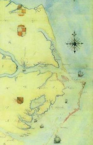
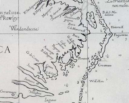
Here are the two versions of White’s map, compared in DeBry’s chosen orientation of West on top:

The point that I want to make here is that John White, without the benefit of a surveyor’s eye, drew a darned fine map! The "extra cape" (what I indignantly and once loudly called it) was not a figment of White’s imagination. It’s real. Andy Powell told us where to find it. So, I looked.
con't here (scroll down when you get there)
This blog is © History Chasers
Click here to view all recent Searching for the Lost Colony DNA Blog posts


