The fate of Sir Walter Raleigh's famed "lost colony" in the New World – and the disappearance without a trace of more than 100 English settlers – has been an unsolved mystery for 400 years, a lost chapter of Anglo-American history. That so many men, women and children could simply vanish has become the stuff of American folklore. Many assume that they were either slaughtered by native American Indians or assimilated into their communities.
Now, a clue has emerged that experts hope could help solve the centuries-old mystery of the settlers' disappearance, and lead them to the site of what Raleigh and Queen Elizabeth I hoped would be a capital, the first English attempt at colonisation.
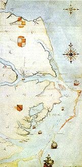
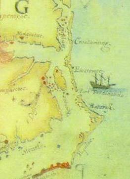
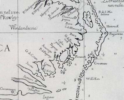
Concealed on an Elizabethan map of the east coast of North America, but now identified by the British Museum, is a hint at the colony's location drawn in what appears to be invisible ink, further disguised by a barely-discernible patch of paper glued to it.
Scientific tests have revealed that a lozenge, the symbol for a fort, was hidden on the map drawn by John White, who accompanied Raleigh's first attempts to establish a colony. White led the settlers who were to establish the "Cittie of Raleigh" of which he was intended to be governor.
Its concealment on the map reflects an age mired in political intrigue – Elizabeth I was then facing plots to place the Catholic Mary Queen of Scots on the English throne – and fears of such a map getting into the hands of court spies.
Invisible ink was concocted at that time from milk, citrus juice or urine, and usually revealed by applying heat.
An official announcement will be made today, but an excavation of the site, now farmland, is planned.
Cont.
Click here to view all recent Lost Colony Research Group Blog posts


