The 2012 Dig
For those of you who follow along, the Lost Colony Research Group has sponsored archaeological digs now on Hatteras Island in 2009, 2010, 2011 and now, 2012. This year’s dig was somewhat different since we feel we have located the original site of the colonists on Hatteras Island in previous years. Additionally, we welcomed to our project this year Dr. Charles Ewen at ECU as well as two additional professional archaeologists.We have been very blessed. Our new project archaeologist is Jennifer Gabriel.As you also know, due to modern day pirates called treasure hunters, we have to keep the sites where we dig a well-guarded secret. Besides, the last thing a property owner wantsto find is their yard looking like swiss cheese when they return home one day, meaning that someone with a metal detector has trespassed and not only stolen historically important items, but ruined the area for subsequent archaeology. So while I can’t tell you exactly where we were, suffice it to say that we are still on Hatteras Island and we are still pursing the colonists. We actually dug in several location this year as our dig time in the field was expanded to two weeks. I will post two or three different blogs that shows some of our different activities and the group as well. We
never had a better group, or a better time. Were it not for the extreme heat, the massive number of mosquitos and ticks, it was almost likea vacation.Refrains from the nursery rhyme,
“
The Old Gray Mare, She Ain’t What She Used to Be
”
played through my head every morning as I got my old, achy self out of bed to go and digsome more.However, this dig was blessed from the beginning. Dawn found a lucky penny and we saw a beautiful double rainbow from the deck of the house that we rented on the firs tmorning. Did I mention that there were 37 steps up and down. If not, I probably will mention that several times
Houses on Hatteras are built on stilts so that the flooding doesn’t damage the contents. However, that means that the first floor is really the secondfloor, and so on.
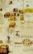
Please ignore the small print below and go here to truly enjoy the full sized version:
2012 Digging on Hatteras
This blog is © History Chasers
Click here to view all recent Lost Colony Research Group Blog posts
Tuesday, June 19, 2012
2012 Hatteras Dig
Monday, June 18, 2012
Crabfest 2012
By Roberta Estes


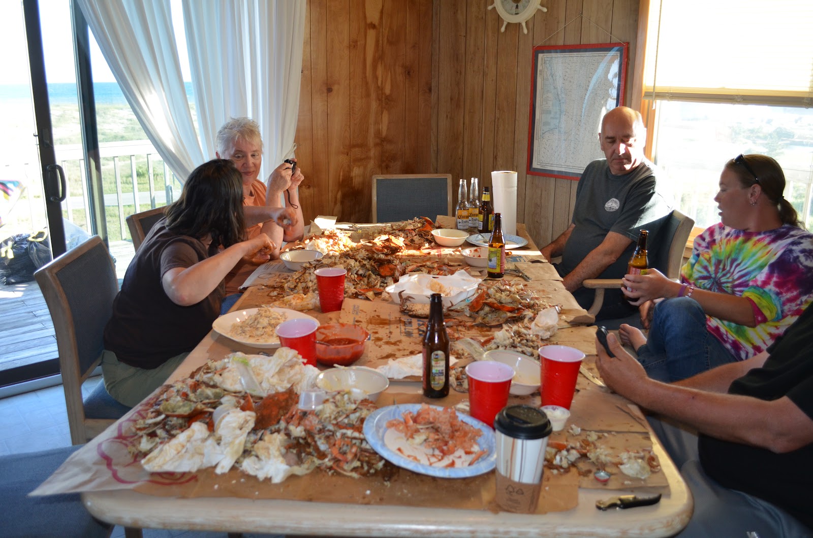
| And
the trash, well, that’s a matter of perspective. Jenn took a piece of crab
outside and was immediately bombarded by the local seagulls. They loved the
pieces we didn’t eat. Apparently, as far as they were concerned, we had not
gotten all of the good stuff. So, share one and share
all. |

This blog is © History Chasers
Click here to view all recent Lost Colony Research Group Blog posts
Saturday, June 16, 2012
Who Are You, Really???
by Janet Crain
Before you shell out big bucks for a population DNA test, trying to determine your ethnicity, be very aware. Costing more or less is not your best guide to their effectiveness. Both 23andMe and Family finder at Family Tree DNA of Houston use exactly the same chip. It tests over 700,000 markers and is the best on the market. 23andMe has lagged a bit behind but should be making some big changes very soon in drilling down into your ancestry. Family Finder is already doing this.
Population Finder
Reveals Ethnic Ancestry
 Population Finder is a report included with the Family Finder DNA
test from Family Tree DNA. Today, this report is the single best option
for measuring a person’s overall ethnic ancestry.
Population Finder is a report included with the Family Finder DNA
test from Family Tree DNA. Today, this report is the single best option
for measuring a person’s overall ethnic ancestry.By comparing your DNA to that of global populations, it does what’s called a biogeographical analysis.
As part of Family Finder, it uses your autosomal DNA, which reflects the contributions of ALL your ancestors going back at least five or six generations.
Some companies market tests that claim to make finer distinctions than this. But their reports are based on such tiny population samples that the results are mostly wishful thinking.
Population Finder is the most scientifically credible ethnic DNA test available today.
http://www.dna-testing-adviser.com/population-finder.html
This blog is © History Chasers
Click here to view all recent Lost Colony Research Group Blog posts
Friday, June 15, 2012
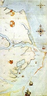
Proof Greenville was born in Bideford
Surprise discovery is ‘proof’ famous sea captain was born in Bideford
 Sir Richard Grenville in 1571
Click here to view all recent Lost Colony Research Group Blog posts
Monday, June 11, 2012
Visiting the Eastern Cherokee on the Qualla Indian Reservation in Cherokee, NC


http://nativeheritageproject.com/2012/06/11/visiting-the-eastern-cherokee-on-the-qualla-indian-reservation-in-cherokee-nc/
This blog is © History Chasers
Click here to view all recent Lost Colony Research Group Blog posts
Sunday, June 10, 2012
2012 Hatteras Archeology Dig
It is not easy trying to locate people who disappeared 425 years ago. One of the problems is just getting there to the place it happened. Here we get a first hand report by Robert Estes of the difficulties she encountered on day one of her trip to the 2012 Hatteras Archeology Dig. JC
~~~~~~~~~~~~~~~~~~~~~~~~~~~~~~~~~~~~~~~~~~~~~~~~~~~~~~~~~~~~~~~~~~~~~~~~~~~~~~
And so, the adventure has begun. Every year, and every dig, has seemed to have a unique set of challenges. In almost every case, we’ve had some weather catastrophe. We’ve had 2 hurricanes, one that washed out the roads, a volcano erupted, a snowstorm, and Andy’s plane was struck by lightning. Other than that, nothing major….
After that, you think, what is left to happen? Well, I have the answer….a rockslide…really, a landslide. They called it a massive landslide. I thought at first there were rocks on the highway, but when I arrived, it was even more frightening. The entire southbound roadway was gone….entirely…..slid down the mountain. All you could see what a wonderful view of the next mountain. Frightening.

Other than my GPS getting itself entirely confused in Knoxville, I arrive in Pigeon Forge with no further excitement. But I’m surely going to drive on the inside lane, not by the guardrail, from now on.
But it seems there is more to the story. WBIR 10 News reports:
MAY 9, 2012 – TENNESSEE – TDOT has shut down all but one northbound lane of Interstate 75 between mile markers 141 and 144 in Campbell County. The earliest any southbound lanes will reopen is Thursday. The shut down comes because the embankment that collapsed beneath I-75 South on March 8 has now grown to threaten the median and northbound lanes. TDOT brought in the big gun to defend I-75 North by hiring an emergency repair contractor from Grand Junction, Colorado. “Myself and my crew got a call yesterday [Monday] and we arrived late last night,” said Nate Beard, vice president and engineer with Soil Nail Launcher, Inc. Beard’s crews will battle a beast of a mountainside with an oversized air gun originally built by the British military. “It is a big compressed air launcher that would launch nerve gas canisters up to seven miles,” said Beard. “It has been modified to launch soil nails, which is a 20 foot long, 1.5 inch diameter steel tube. We build that compressed air up to 3000 PSI, pull the trigger, and then it accelerates into the ground at 250 miles per hour.”
In Campbell County, soil nail launcher crews are taking aim at a moving target. “The big challenge here is it is an actively moving landslide. I walked across this road at midnight and at 2:00 in the morning all of that material had fallen down to the bottom of the slope,” said Beard. “Our top priority is protecting the northbound lanes. We’ll launch around 300 soil nails. We’ll put them in a really tight spacing. It works with the soil particles to confine them and create a beam effect, which then supports the interstate. It takes a lot of those loading and driving forces off the landslide.” Beard said crews should finish nailing the northbound lanes by Wednesday morning. Then they will hammer away at the southbound lanes with even larger soil nails. “The south lanes can use nails that are 50 to 60 feet long and two inches in diameter,” said Beard. “You drive along these roads and they are perfect and they are flat, but they are on the edge of a cliff. A lot of people take that for granted, but the fact is there are frequently things like launched soil nails beneath the roads to keep them secure and stable.”
So I was driving on the unstable northbound lanes on top of a migrating, creeping landslide. I feel much better. The photo below shows the highway, down the embankment, with a few trees and such. I wonder if there are any vehicles down there that were on the road when it collapsed. Driving where there is suddenly no road is the stuff nightmares are made of!

Pigeon Forge
The first stop is Pigeon Forge, which doesn’t even resemble the Pigeon Forge in my memory. The road used to be 2 lane, to begin with, and while there were some stores, there are now outlet malls and it looks more like Florida near Disney World than Tennessee. I guess that would be the effects of Dollywood. Glad to be moving on to Cherokee, NC tomorrow and glad I didn’t try to drive it tonight.

This blog is © History Chasers
Click here to view all recent Lost Colony Research Group Blog posts


