Lawrence Crain, husband of Janet Crain passed away October 19, 2009 at his home in Lampasas, TX. Janet is my cousin, friend, and noted researcher. My heart and prayers go out to her and her family.
Lawrence Charles Crain, 71, of Burnet County, passed away at his home October 19, 2009, from cancer and a stroke. Lawrence was born April 12, 1938, in Corpus Christi. He was the third of six children born to Blanche Evelyn Rucker and James Thomas Crain. His formative years were spent in Texas, New Mexico, and California. The family then moved to Bremerton, Washington, in 1955, where Lawrence enlisted in the United States Air Force. Returning from Okinawa to the United States in December, 1957, Lawrence visited his family in Burnet where he met his future wife, Janet Elinor Lewis. The couple wed April 18, 1958 and began their married life in Altus, Oklahoma. When Lawrence was discharged, he returned to Burnet, until he was hired to work as a civil servant at the Altus AFB. He continued his employment with the government at Ft. Hood for five years. Moving to Austin, Lawrence completed the United Brotherhood of Carpenters’ and Joiners’ apprenticeship program, earning his master carpenter’s certification in 1971. He worked on various projects in the Austin area, including the LBJ Library and Texas Memorial Stadium. He continued working in the Austin-Highland Lakes area, until he returned to employment at Fort Hood in 1981, from which he retired in 1998. Lawrence enjoyed fishing and passing on the skills to his children and grandchildren. Moving to north Burnet County in 1985, he built a house for his family, and enjoyed hunting and pursuing his passion for antique car restoration. In recent years, he spent time online working on genealogical research and relished the small discoveries that revealed pieces of his family’s past. Lawrence is survived by his wife, Janet, of 51 years, and his children; David and his wife, Randa, of Sweeny, Texas, Diane and her husband, Chuck Humphrey, of Ozark, Arkansas, and Darrell and his wife, Michelle, of Burnet. He is also survived by his siblings; Melvin, and wife, Pat, of Coeur d’Alene, Idaho, Tommy and wife, Debbie, of Burnet, and Rebecca Bingle of Burnet. Thirteen grandchildren; Rhea Holik, Melody Cobb, Zachary Crain, Destiny Stebbins, Clairessa Campbell, Madelyn Humphrey, Abigail, Lydia, Ethan, Samuel and Josiah Humphrey, and Austin and Dillon Crain. Eleven great-grandchildren; Ashlee Holik, Blaine and Emma Cobb, Miles and Abigail Stebbins, Mackenzie Malone, Nathaniel, Collin and Simon Campbell, and Alivia and Erik Hill, and numerous nieces and nephews and extended family. He was preceded in death by his parents, and older sister, Billie Jean Phyle, and younger brother Laurice Ray Crain. The family would like to thank the dedicated people of Lighthouse Hospice for enabling us to grant the wishes of our loved one, and bring Lawrence home. Memorial contribution suggestions are to St. Jude’s Hospital or the American Cancer Society Hope Lodge of Lubbock. Pallbearers will be Zachary Crain, Ethan Humphrey Austin Crain, Samuel Humphrey, Jason Holik, Travis Cobb, Honorary Ken Bernhard, William DuBose, Jerry Ratliff, James Smith, Leeman Foster, Bill Manning, James Roberts. Graveside services will be Thursday, October 22, 2009 at 2:00 p.m. at the Smithwick Cemetery. Arrangements by Clements-Wilcox Funeral Home in Burnet, Texas.
© History Chasers
Click here to view all recent Searching for the Lost Colony DNA Blog posts
Tuesday, October 20, 2009
Lawrence Crain

Sunday, October 18, 2009
Stephen B. Weeks Article
THE LOST COLONY OF ROANOKE
ITS FATE AND SURVIVAL
BY
STEPHEN B. WEEKS, PH.D. (JOHNS HOPKINS)
[REPRINTED FROM PAPERS OF THE AMERICAN HISTORICAL ASSOCIATION
VOL. V., PP. 439-480]
NEW YORK
The Knickerbocker Press
1891
PRICE, FIFTY CENTS
read online here
copyright usage statement
© History Chasers
Click here to view all recent Searching for the Lost Colony DNA Blog posts
Monday, September 21, 2009
New 23andMe Autosomal Test Opportunity
New 23andMe Autosomal Test Opportunity – Very Limited Time
Recently I have been invited to gather a group to participate in a very special beta group at 23andMe.
I want to state very clearly this offer is for a very limited time. If you wish to participate, KITS MUST BE ORDERED BY SEPTEMBER 30TH (2009) AND RETURNED TO THE LAB NO LATER THAN OCTOBER 30TH.
Secondly, I had to agree to not post the price online nor the special discount code for our group online, but let’s just say that the price is in the ballpark of the DNA tests we are used to from the major DNA testing companies. If you want to know more, e-mail me privately and I’ll send you both the price and the discount code to order, but I must ask you to not post the price info nor the code online anyplace. You can distribute this to family and friends under the same conditions.
When I took this test, it cost $995. The current public price is $399 for the full service test and this special beta price is dramatically less, in fact, it’s only slightly more than their Research Edition test listed here https://www.23andme.com/researchrevolution/compare/, but because of the special nature of this project, you get the full test for the discounted price which is slightly more than the Research Edition.
For this special price, you receive all of their Ancestry results which you can see here https://www.23andme.com/ancestry/ and their 116 genetic traits which you can see here https://www.23andme.com/health/. As new tests come online, your results are provided for those tests for free, or at least this has been the policy to date. I’ve been quite pleased as new information has been added to my personal account.
For those who don’t know, 23andMe is a DNA testing company that provides some information to genealogists regarding haplogroup information and percentages of ethnicity, but has traditionally focused more on genetic health traits. www.23andme.com
New Autosomal Focus and Product – Relative Finder
In the past few months, their focus has changed somewhat.
First, they are now only one of two companies who provide a percentage of ethnicity and it’s included in their one-price test. This percentage includes European, African and Asian, and for the purposes of the people in the US looking for Native American ancestry, the Asian percentage is proxy for the Native American. It’s not perfect, but it’s the best there is today.
Second, they have been working very hard on autosomal testing, which is indeed the focus of these beta groups of 50 individuals. A new product called “Relative Finder” will compare your DNA to that of other individuals to see who you match and who you don’t and will hopefully help you to discover people to whom you are related. The demonstration for this new feature is not yet available, but will be soon. It may not be available before the end of the discount period, so if you are interested in participating, do NOT wait on this demo to be available or you may miss the window of opportunity (Sept. 30th).
Many of us have taken the Codis, autosomal or DNAPrint tests with the hopes of determining what ethnic group we match or if we are a match with a particular individual. These tests use between 15 and 21 markers, typically the same markers used for forensics. This new test uses over half a million markers for each person.
Rather than try to describe this to you, I’m going to quote Ann Turner (MD) who was one of two authors who wrote the book “Trace Your Roots with DNA: Using Genetic Tests to Explore Your Family Tree” which is still the best basics book on genetic genealogy available.
Dr. Turner says, “The current discount is for the full product, and it only applies during a beta test period for a new feature at 23andMe. The type of test offered by 23andMe doesn't replace Y-STR and mtDNA HVR (or FGS), although "deep ancestry" results can help sort out some coincidental matches.
The potential breakthrough for genetic genealogy is the vast amount of autosomal data: 550,000 SNPs, vs the couple of handfuls of CODIS-style STRs you probably ordered elsewhere. If this pans out, it means that projects
(surname/geographical/ethnic) don't need to confine themselves to the straight paternal or maternal lines, but they can include people whose ancestry zigzags back and forth between males and females.
Genetic genealogists just aren't dialed in to thinking about all the "other" ancestral lines. In order to introduce and (hopefully!) demonstrate the utility of autosomal testing for finding connections between people, discounts were offered to a few project administrators.
For instance, one way to use autosomal testing in a surname project would be to calibrate whether a Y-STR match represents recent ancestry (say 4th cousins or so) or is likely to be more distant. Also, women who don't have a straight paternal line could participate in a surname-oriented project if they think they might share a recent ancestor with a male in the project.
Projects limited to a well-defined geographic area or ethnicity may be able to identify multiple connections between people and assemble an autosomal picture of the founders. Again, this would open up projects to people who lack a straight maternal or paternal line.
Nothing like this has ever been attempted before, so we are just beginning to explore the potential. It will also be important to understand the limitations.
One way to use this type of testing would be to narrow down the inheritance of medical conditions. Some of you may be investigating a medical condition that is found in your extended family, like I've been doing for an autosomal dominant hereditary hearing impairment where the gene is unknown. By testing 6 cousins, some with and some without the condition, I've been able to narrow down the possibilities to one region on chromosome 15. Some of you may even know the name of the gene but wonder if you've inherited the same stretch of DNA as a cousin with the condition.
Some of you may have found some clues about an adopted great-grandfather and wondered if you've really located a living cousin. The Family Inheritance diagram at 23andMe would highlight an area of DNA that you share. (Anyone can create a demo account and view various diagrams and reports for a real family, the "Mendels".)”
A third way would be to test multiple people from a family, ethnic group such as the Amish or a particular geography (such as the Cumberland Gap) who are or might be related in some manner and to see which chromosomes they share.
Basicly “relatedness” testing can also be achieved in this manner for people who think they may be related and for whom the siblingship or extended family testing has proven inconclusive.
Well, you get the picture. There are many other hypotheses that could be investigated with autosomal DNA once you begin to think about it.
Here, Blaine Bettinger discusses his experiences with the 23andMe test:
http://www.thegeneticgenealogist.com/2009/03/11/genetic-testing-with-23andme/
Here he discusses the ancestry portion of his testing and the Ethnic percentages:
http://www.thegeneticgenealogist.com/2009/03/12/genetic-testing-with-23andme-ancestry-testing/
A related article can be found here:
http://www.thegeneticgenealogist.com/2009/09/21/the-future-of-genetic-genealogy-tracing-dna-to-individual-ancestors/
The Bottom Line
The bottom line is this. I can’t tell you what you’ll get out of this endeavor except for their normal products, which alone is an incredible value for the price you will pay. You will be participating in a new research endeavor and you may indeed be part of finding that “Holy Grail” for genealogists, discovering how to effectively use autosomal DNA to determine not only race and ethnicity, but degrees of relatedness to other individuals. One thing is for sure, if you don’t participate, you’ll never know. I’ll be there. Hope to see you there too.
If you are interested, e-mail me personally and I will send you the pricing information and the code to join.
Roberta Estes
robertajestes@att.net
© History Chasers
Click here to view all recent Searching for the Lost Colony DNA Blog posts
Saturday, September 12, 2009
Cherokee Revealed - Translated Moravian records disclose a forgotten history
Hat Tip: Laree
Cherokee Revealed - Translated Moravian records disclose a forgotten history
CHURCH MISSIONS: 19TH-CENTURY DOCUMENTS

Courtesy of Moravian Archives, Bethlehem, PA.
This map showing the settlements of the Cherokee Nation was drawn by Moravian missionary John Daniel Hammerer and is dated to 1766.
Published: September 8, 2009
In front of the house stands a long, open shed covered with clapboards adequately provided with benches and other seats, as well as a raised plank for writing on. The Talk was held under this shed. At a short distance from this stands a tall pole. A designated Indian took his position at this pole with a drum, and beat the drum as a sign of the beginning of the meeting. He kept drumming until Indians were seen coming in lines. In the heat, the Indians used turkey wings in stead of fans to make a breeze for themselves. -- Report from Abraham Steiner, a Moravian missionary to the Cherokee at Springplace, Ga., May 22, 1801, translated from the German.
This glimpse into the shared history of Moravians and Cherokees was shrouded in archaic German script for over 200 years at the Moravian Archives in Winston-Salem.
The words were found among hundreds of diaries, letters and other papers that recorded about 100 years of history between the Moravian missionaries and their Cherokee brethren. The records constitute the only known account of daily life in the Cherokee nation.
In 1992, workers began to translate and transcribe the documents. But money grew tight and work slowed on the project because the staff had to consider prioritizing other projects and possibly cutting back hours or staff, said Daniel Crews, the archivist of the Moravian Church, Southern Province.
Then earlier this year, members of the Cherokee Nation made a $125,000 grant, to be paid over five years, to translate and transcribe the documents. The archives have committed two archivists to work on the collection two days a week for the next five years, Crews said, with the hope of publishing their findings in a series of books after the work is complete.
The Cherokee Nation is made up of those people descended from ancestors who survived the Trail of Tears, the removal of the Cherokee in 1838 from the Eastern United States to the Indian Territory, which is now Oklahoma.
The Eastern Band, the Cherokee whose ancestors went into the mountains rather than accept removal, have also agreed to help pay for the project, Crews said, but have not announced how much they will donate.
The records contain details about what the Cherokee ate, how they built their villages, and the way they danced and dressed.
Jack Baker, a member of the Cherokee Nation tribal council, said that such information is available nowhere else.
Cont. here:
© History Chasers
Click here to view all recent Searching for the Lost Colony DNA Blog posts

Sunday, August 23, 2009
Roanoke Island Trip - Day 5

Day 5 - August 20 – Thursday
by Roberta Estes
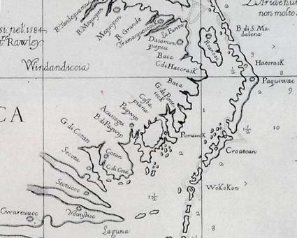
I’ve been looking forward to today for 2 years now. Anne and I are going to Hatteras Island which is where Croatoan is located. Croatoan, if you recall, is the location that the Lost Colony carved on the post and the tree at Fort Raleigh as a message to John White telling him where the colony had removed to. He found it on his return voyage in 1590 and was thrilled that the colonists were among the friendly Indians headed by Manteo, their friend who had gone with them to England twice.
John White was also greatly relieved by what he did not find; no cross. Their agreement was that if the colonists left under duress or in distress, they would carve not only their location, but a cross. There were no crosses anyplace, and the houses had been disassembled and removed, not ransacked, so their move was obviously orderly and planned, not hurried.
John White wanted to visit Hatteras Island, they called Croatoan, but a violent storm interfered with is plans, drowned some of the men, and nearly sank their ships. They had to abandon those plan and return to England. So close, yet so far away.
Anne and I retraced that journey today. After leaving Roanoke Island, we crossed the bouncing bridge and turned onto NC 12. NC 12 is the ribbon highway that runs the length of Hatteras land for more than 50 miles. The island starts out running North to South, but does a dog-leg turn in about 45 miles at Buxton and then runs East to West. The North to South portion is generally not inhabitable. Now of course there are a couple of tiny villages with a few hearty souls who must not need insurance who have built right on the sand dunes on the ocean on a tiny spit of land not more than an eighth of a mile wide in some locations. But these locations do not support any agriculture because there is only sand and no dirt. In fact, these areas are quite picturesque. The park service has erected sand fences in some areas to attempt to reduce erosion and the sand drifts around the fences. However, the road has been washed out many times and new inlets through the island are often created during hurricanes and other bad storms, letting us know indeed how fragile those islands truly are.
In some locations, maritime forest exists on the islands. While this is different than mainland forests, it’s still beautiful and often blocks the view of the ocean making the distance to the ocean from the road seem far greater than it is.
This site has beautiful photos of the Outer Banks. Take a look and share the unique charm and the stark beauty. You can see Maritime forest in many of these photos.
http://www.duke.edu/~jspippen/vistas/outerbanks.htm
We stopped in Buxton and visited Scott Dawson at the Croatoan Inn. Scott and his wife own the inn and Scott has a beautiful collection of Native artifacts found on the beaches and elsewhere on Hatteras Island.
http://www.thecroatoaninn.com/
Scott is a wealth of information about the history of Hatteras Island. He is passionate about the colonists who he believes assimilated with the Indians. Indeed, they told us they were going to Croatoan and Hatteras Island is Croatoan. This part of Hatteras Island is the first location between Roanoke and the end of Hatteras Island that can sustain a population and grown food, and the Indians have inhabited that island at least seasonally for thousands of years.
Scott has done a great deal of research on the topic and his book “Croatoan, Birth Place of America” is now in its second printing.
http://www.buybooksontheweb.com/product.aspx?ISBN=0-7414-5469-6
We had read the book and wanted to see the area for ourselves as well as some of the landmarks Scott discussed in his book. Even though he couldn’t leave the hotel and go with us, he was kind enough to tell us how to locate several items, including the Cora tree.
The Cora Tree and the coffins are in very close proximity. The coffins were, unfortunately, reburied many years ago, right after they were accidentally excavated by a drag line operator before anyone realized the significance of what he had stumbled upon. However, we do know the general area where the canal digging as going on and the Cora tree is in the same vicinity.
The Cora tree is quite interesting, although maddeningly inconclusive just like so much else about the Lost Colony. Recalling that the colonists were to carve the location of where they were moving on a tree or post, this tree is over 1000 years old, so even in 1600 or so it would have been remarkable. At that time it was already 600 years old, a substantial tree.
Did the colonists carve a second message to their hoped-for rescuers after they moved to Croatoan? Were they trying to tell John White where they went if they moved a second time? Is Cora similar to Coree? The locals tell the story that
Cora was a witch who was hung in the tree and lightening carved the name Cora in the bark.
From there Anne and I drove around the area where we knew the coffins to have been, and revisited the sites of earlier archaeological digs, although there have been very few on Hatteras Island, with most digs being focused on Fort Raleigh and that area. Earlier digs on Hatteras (Croatoan) were very successful, unearthing a gunlock and the Kendall family signet ring among other English items. In the 1930s, a man found a sword in that area as well. Again, while confirming the presence of the English on the island, it doesn’t confirm that the colonists themselves were there and that that they weren’t later artifacts. Kendal was in the 1585-86 military expedition, but not in the 1587 group, so we may be finding artifacts from the military expedition, not the colonists themselves.
How I would love to test the DNA of the skeletal remains in those caskets. It could potentially tell us a great deal about what happened between 1587 when the colonists moved to Croatoan and the next “sighting” we have directly of their descendants which is in 1701 when John Lawson visits the Hatteras Indians and reports that they have grey eyes and some have light hair as well. The Hatteras told Lawson that their ancestors were white people and talked in books. The Hatteras also tell of a ghost boat which appears on misty nights and is Raleigh’s boat which has come for them.
How many misty and foggy nights indeed did the colonists spend watching for any sign through the mists of their rescuers? Did they every give up waiting? At some point, had they assimilated so well into the Native culture that they no longer wanted to be rescued? Did they in fact survive to have descendants in the present generation, or did they survive only long enough to be annihilated by disease or warfare with other warring nations and the white settlers as well during the long and bloody Tuscarora War and preceding events?
After some artifact hunting on the beach, from which we turned up empty handed, we ate at a place that passes for fast food. Let’s just suffice it to say it took as long to get a salad, burger and piece of pizza as it would have taken to wait on a table at the nicer restaurant (20 minutes) and have ordered and eaten a dinner. Let’s just say that calling the food mediocre would be doing it a favor. That restaurant is definitely on my “never again” list.
Our drive home was in the dark, and it’s amazing just how dark dark is on the island. Of course, there are no street lights and in the areas with no habitation, there is also no ambient light. The mainland is often out of sight and if you look eastward of course there is just ocean and more ocean. Anne and I watched the ocean and wondered if Hurricaine Bill will cause severe rains and flooding, but this evening, and for a couple of more evenings, Hurricane Bill isn’t a problem. But one this is for sure on the Outer Banks, if this hurricane misses you, there’s always another one waiting in the wings. The surfers count on that.
We arrived home under the poplar tree quite late, for the last time for me. I packed and got my car ready to load in the morning. I slept restlessly trying to decide whether to risk the traffic by going north by Washington DC or take the longer route westward and up 77. By 4:30 AM or so, I had come up with a compromise plan which took me north to Richmond they west on 64 which should keep me out of traffic and rain with little backtracking. My GPS this morning was not happy with my decision. How I just love having a bossy woman in my car. I swear she sounds more disgusted with every direction of hers that I don’t follow. She gets confused sometimes and got herself all bolluxed up near Richmond, nearly sending me to Washington DC in spite of what I told her to do.
This morning when I woke up, I looked out the bedroom window to see condensation running down the window….and it wasn’t raining. It was just that humid. No need to dry your hair here, because it’s going to be wet again in 2.7 minutes. And makeup – only waterproof. But none for me thank you…..I got over that about the same time I got over staying up late.
As I was loading my car for my final trip across the bouncing bridge, Turkey Lurkey ran up and offered some parting advice….I’m not sure I understood her correctly, but I think it was something about not celebrating Thanksgiving this year.
Read all posts in the Trip to Roanoke series:
© History Chasers
Click here to view all recent Searching for the Lost Colony DNA Blog posts
Saturday, August 22, 2009
Roanoke Island Trip - Day 4

Wednesday – Day 4 - August 19th
After staying up way too late last night at the cast party, we slept a little late this morning. I can’t remember the last time I as up till 3AM for a positive reason! However, even with nothing stronger than water to drink, I could certainly feel the late night this morning. How did I ever think this was fun when I was younger?
By noon, Anne and I were absorbed in acid free boxes chocked full of surprises at the
I made another important discovery today. There are no quilt shops on the Outer Banks. Now you’d think with nearly 100 miles of ribbon-like highway and thousands of tourists on that one highway, at least some of them would be quilters and would want to take home more than a shirt, a sunburn and some sand in their shoes for souvenirs. Apparently not, because there not only aren’t any quilt shops, there aren’t even any plain old vanilla fabric stores. Hello, how can you live without JoAnne Fabrics? The closest store is at the far northern end of the
When visiting the Outer Banks, you have to stop at Kitty Hawk Kites. Kitty Hawk Kites is quintessential Outer Banks. Where is Kitty Hawk Kites? Everyplace. There are many of the stores and yes, they have just stunningly beautiful kites. One thing the Outer Banks always has is wind…and it‘s so hot there that you’ll be exceedingly grateful for that wind, let me tell you. So it’s also a kite flyer’s dream and even if you can’t fly a kite, you can there. There’s no way you can’t fly a kite on the shore line, so indeed, go fly a kite.
I was looking for a particular t-shirt. I bought the long sleeve version 2 years ago, and I wanted a short sleeve one as well. It says “don’t ask the locals for directions, they’ve lost one colony already”! Yep, my kind of place. Of course, sale is the word that Americans are in love with so if you tell them the second t-shirt is on sale, you’ll sell 2 for sure. My second (half price) t-shirt says something akin to “Woman who behave don’t make history”. In honor of the fabric, it’s kind of coral colored and has a small insignia size pirate skull and crossbones on it. I’m liking my pink pirate fabric better already. I always love visiting Kitty Hawk Kites! It’s a vacation for your inner child.

We ate at the Beach Road Grill, a long-time local favorite and had their house-special steamed and spiced shrimp, served hot with drawn butter and cocktail sauce, along with black beans and rice. Their black beans and rice are served half on one side of the dish and half on the other (rice on one end and beans on the other) with hot salsa across both halves. Nothing like this up north, I guarantee you. Lovely waitress as well. Southern hospitality at its best. The harmonica player was going to start shortly, but we were just too tired to stay up late again, so we left amidst a beautiful sunset, crossed the bouncing bridge, watched the lightening over the sound above Manteo and went home under the poplar tree and called it a night.

Read all posts in the Trip to Roanoke series:
© History Chasers
Click here to view all recent Searching for the Lost Colony DNA Blog posts
Wednesday, August 19, 2009
Happy Birthday, Virginia Dare!!!

Roberta Estes and Anne Poole
Day 3 – August 18th – Tuesday
HAPPY BIRTHDAY VIRGINIA DARE!!!!
Little
But the Virginia Dare we are all familiar with is the child, the baby, born on August 18th, 1587, to her young mother, Eleanor White Dare, wife of Ananias Dare shortly after landing on
The Virginia Dare Faire at
We were fortunate that 2 of our members, Aleda Bunch and Jeri Evans, joined Anne and I for the day. There were lots of questions to be answered as many people stopped by and we needed the help, but more importantly, we go to know each other and had a lot of fun. We were also pleased to discover that two couples came specifically to talk to our group, but most people had a more general curiosity.
Interestingly enough, one of the most interested individuals was a young tour guide who works at

Anne talking to visitors
I must say that I don’t think I’ve ever met a nicer group of young people. Most of the staff there consists of college students. All of them were friendly, polite and some were genuinely interested in our project. They smiled and were engaging and helpful. And I must add that most were dressed in stifling wool costumes, floor length, long sleeves, and they must have been miserably hot. We were sweating like faucets stuck “on” and we certainly weren’t in authentic period costumes. Bravo to them for their sunny dispositions!!!
We decided that everyone must want to be an Indian in the cast, because although Ananias Dare is clearly a “leading man”, the Indians are much more comfortable in their costumes. The Queen passed through and traditionally cuts the birthday cake for Virginia Dare, but surely no one wants to wear her wardrobe in hot sultry August in NC.
After the Faire ended, Anne and I visited with Doug Stover, the Cultural Resource Manager at
Tomorrow we’ll be using another local resource, the
http://www.obhistorycenter.ncdcr.gov/
Tonight, we travel the road beside the swamp to the stop light at the intersection of the bouncing bridge, back to Manteo, through the tree lined streets with names such as Grenville, Amadas and Ananias Dare. We return to the
Two years ago, we were invited to a very special event after the play. It has now become a tradition that we look forward to every year. Traditionally, Virginia Dare’s birthday is either the last production or the next to last production of the play for the season. Dignitaries are present, of course, and there are special events and awards to the actors and crew who deserve outstanding merit.
One of the most special events is the cast party after the play behind the stage. The area behind the stage is directly on the sound. Parts of the stage are built on a deck that is extended over the sound, and the sand in front of the stage is truly beach sand. By the time the play is over, darkness has fallen and thankfully, the heat has diminished a bit. Volunteers and local businesses provide food for the cast, staff and volunteers, and everyone sits together at picnic tables, visits and of course eats wonderful home-made southern food. (Anne is taking ham, green beans (with bacon fat of course), potato salad (a southern must) and Scotch Cake (some kind of the most wonderful smelling chocolate concoction). Cast members have created their own entertainment, sing, dance, so skits and entertain themselves and others as well. They have become family, indeed, throughout the summer and although we were not family members, they welcomed us warmly into their world. What a beautiful end to the perfect day, looking over the sound, watching the stars, the moon rising over the water and knowing that whether the Colonists survived and moved on or died on Roanoke Island, we’re sharing the same sand, land and stars, a few generations and 422 years removed.
Read all posts in the Trip to Roanoke series:
© History Chasers
Click here to view all recent Searching for the Lost Colony DNA Blog posts
Tuesday, August 18, 2009
Important Find Housed in Lindsay Warren Visitor's Center on Roanoke
Once this gorgeous copper necklace flashed in the sun as its wearer proudly exhibited his or her possession.
Then for hundreds of years this beautiful necklace lay hidden in the sand awaiting its place in the sun once more.
Last Fall, the archeology group, First Colony Foundation, with the help of a radar sub contractor, uncovered the copper necklace in the wooded sand dunes not too far from the theater.
It was an exciting time to see it "in situ," said foundation archeologist and co-director Eric Klingelhofer.
The necklace is on display at the Lindsay Warren Visitor's Center located in the Fort Raleigh National Historic Site, which encompasses the visitor's center, the Lost Colony and Elizabethan Gardens.


Necklace found on a dig last year on Roanoke.Found near the theater where the Lost Colony Drama has been performed for 72 years.
Related:
http://the-lost-colony.blogspot.com/2009/08/copper-necklace-inspires-more-digs-at.html
http://books.google.com/books?id=VcH2Ym_ImPEC&pg=PA109&lpg=PA109&dq=roanoke+copper+necklace&source=bl&ots=peacWYI5MI&sig=4r03TrWyCPV9SLgEPgvDQ0rvzBM&hl=en&ei=R8eKStCEDpuwtgeIvdQd&sa=X&oi=book_result&ct=result&resnum=6#v=onepage&q=&f=false
© History Chasers
Click here to view all recent Searching for the Lost Colony DNA Blog posts
Monday, August 17, 2009
Live Blogging From Roanoke Island - Day 2
Outer Banks Day 2- Monday - August 17th
by Roberta Estes
What a beautiful glorious summer day on the Outer Banks.
Today Anne and I rested and prepared for tomorrow’s Virginia Dare Faire. We called this our “girlfriend day” where we just “hung out” and did fun things.
We worked on our research at the house this morning. We have been working on an individual research plan, per county in early eastern NC. Our plan today was to visit various bookstores, so we needed to know what is available and what we need before we ventured out.
We left just in time for lunch. We eventually found “Big Al’s Soda Fountain and Grill” which was conspicuously hidden right on the main drag in Manteo. Big Al’s is quite interesting because the family has a Coca-Cola collection displayed in cases in the lobby. Did you know that there were 3D Coca-Cola glasses or a Coca-Cola Barbie? Well, me either. I do remember those small bottles that used to come out of the old cooler-style dispenser machines and no modern Coke product tastes anything like the frosty cold Cokes in those bottles. Those were the days. Oh, yes, and we did eat there too. Their homemade BBQ is the best!!! Kids were dancing on the dance floor. Just pure all-American fun. Check out their website.

From there we drove across the bridge between
From Mann’s Harbor, we could look back at
I also learned something very important about Anne. She walks looking down at all times, looking for artifacts. She didn’t find any today, but you never know. And you won’t find any if you’re not looking, that’s for sure.

http://www.outerbanks.com/fortraleigh/
The newest treasure at the

Following the Visitor’s Center, Anne and I visited the location of the Lost Colony play to get the lay of the land for the Faire tomorrow. We’re going to be located under the breezeway near the John White pictures. How appropriate. And the breezeway near the restrooms is truly a coveted location. We’re looking forward to tomorrow.
We sat for a few minutes in the outdoor theater in the shade and watched the rehearsal for tonight’s play. We noticed that the young men spent an inordinate amount of time rehearsing the brawl and fight scenes. Everyone seems to enjoy those!
We had to hurry to get to downtown Manteo before the sidewalk gets rolled up between 5 and 6. This beautiful, quaint, waterfront town is indeed an old-fashioned, lovely, walkable downtown that is completely safe and wonderfully inviting. Lots of beautiful, clean, owner-operated shops including the Manteo Bookseller which was our destination. We purchased more books there about the Lost Colony, and now we have enough reading material to last another couple of years. Manteo Booksellers carries truly local titles not available elsewhere. The owner stayed late for us to complete our shopping (although we didn’t realize that until we saw the closing time when as we left the shop) and the shop’s cat wasn’t yet back from his afternoon walk, so I’m betting the owner had to go cat-hunting after we left. You don’t find this kind of service in chain stores, but then again, they do stay open later than 6PM too. No chain stores here to worry about though.
Another stop at the grocery store, and we returned home to cook for cast-party dinner tomorrow night after the last running of the Lost Colony play for the season. (Anne’s cooking, I’m blogging.) Tomorrow’s last performance of the season is special in part because a live baby is included for the part of Virginia Dare instead of the customary doll for the rest of the season. Afterwards, a party is held backstage overlooking the sound for the cast and volunteers and those who work so hard during the production season to make the Lost Colony play the memorable event that it is. No matter how many times you see it in the beautiful outside amphitheater that overlooks the sound, it’s always beautiful and special. Of course the 2008 season introduced the new costumes after the tragic fire in the fall of 2007 that destroyed the costume barn.

After returning home, dinner this evening was a picnic on Anne’s lovely screened-in porch, under the poplar tree, in the quiet peacefulness with the smell of the sea air. I can see clearly why so many people return here year after year, and why Anne had to have her summer home on the island of the Lost Colonists. I thought she had come here to search for them, but now I’m not so sure she isn’t planning on joining them permanently here on the island!
See you all at the Virginia Dare Faire.
Read all posts in the Trip to Roanoke series:
© History Chasers
Click here to view all recent Searching for the Lost Colony DNA Blog posts
Report from the Outer Banks

Baum bridge over Roanoke Sound
Day 1 Aug 16 2009 Sunday
By Roberta Estes
I had been looking forward to arriving on the Outer Banks for the Virginia Dare Faire for weeks now. My car looked more like I was moving than going on a working vacation. I felt like a modern day Beverly Hillbilly. Anne has moved into her summer home in Wanchese and I’m contributing things from my mother’s home. It’s only fitting it seems, as Anne and I are on a mission together and I’ll be staying with her from time to time as we research and search for the Colonists.
So the back of my Jeep has the seats laid flat, a table with the legs removed, several boxed with miscellaneous kitchen paraphernalia that each has a memory for me, and of course really important things like books relating to our search, several inches of paper relating to our research plan, and, oh yes, trivial necessities like clothes. Of course, I can’t go anyplace without my electronic tether, or lifeline, whatever the days perspective…..my computer and cell phone. I’d be lost without either.
Last night after arriving, I answered e-mails and sent clients information and kept up with the world outside of Wanchese. But back to the Outer Banks.
I drove from Michigan via Pennsylvania, Maryland and Virginia this time, as opposed to the more westerly route down 77. I have driven that before to Washington DC, but never beyond. The area through Pennsylvania and Maryland is connected to my early German families and I always think that I need to do more research on them and stop and see where they lived. But that trip will have to wait for another time.
Given that I was in the area of our nation’s capital on a weekend, I didn’t mind risking the Capital Beltway, but I’d never do it on a weekday. That’s analogous to taking your tourist type life in your hands. The 150 miles and supposed two hours I would have saved taking this route would have been likely to evaporate in a single traffic jam.
But on Sunday I whizzed around Washington and noticed that building construction continues there. They apparently aren’t experiencing the same level of recession we are suffering under in Michigan where there is no building and many half-constructed buildings have been abandoned and sold at auction. I whispered my perennial prayer for wisdom and guidance for those in power as I drove by….although my prayers perennially seem to go unanswered in regard to politicians.
I stayed in either Thornburg or Woodford. It’s a schizophrenic place. The Google map and the Holiday Inn website say Thornburg, but my GPS doesn’t know Thornburg Virginia exists, so I called the Holiday Inn and they said “oh yea, type in Woodford. Ok, so Woodford it was. And Google had the location the wrong expressway too, but details….who cares. At least my gps could find it after I typed it the second city. Maybe it’s like a maiden name and a married name for women…..
The free internet was awful, the room had once been a smoking room (do they think we can’t smell), but today the entire property is nonsmoking, and I managed to leave have of the cheesekeeper I was using to hold watermelon in my cooler. Rats. I always take a last look around the room too…..but I missed it somehow and I’m sure that the cleaning staff took one look at that and said “oh well” and into the trash it went. One more of Mother’s things I don’t have to figure out what to do with I guess….but that wasn’t what I had in mind.
Next I passed Richmond and Newport News which began to look like a coastal area with boats, ships really, and cranes and port type of paraphernalia towering over the horizon. Before arriving at Newport News, the area looked strikingly colonial, not nautical. I’m always amazed when traveling in the eastern Virginia area, even near large cities, how wooded the landscape remains. The expressways look more like parkways and not like the sprawling cement ribbons that clear everything to desolation with half a mile in all directions that we have in the Midwest.
South of Newport News, I encountered a surprise. My GPS indicated that I was going to cross an expanse of water, which would be my first real glimpse of the Atlantic on this trip. As I approached, I noticed signs for a tunnel. Hmmmm…..now tunnels are not my favorite things, but they are a fact of a driving/traveling lifestyle, and once you’re in route they are impossible to avoid, so tunnel it was. This tunnel was unusual though in that it only went half way across the channel or estuary and rose in the middle of the river (whatever you call these wide entrances into the ocean that empties fresh water into the ocean but is also tidal in nature) and became a bridge for the second two thirds or so of the crossing. How so they keep the tunnel from flooding? Amazing. However, I noticed the large “doors” on the end as I entered which made me a little nervous and could be the makings of a horror movie or a nightmare, but I chose not to think about those. They are probably closed during hurricanes.
Speaking of hurricanes, when I left Michigan, there had been none yet this year. Last night there were 3, one which arrived in Florida already and is weakening, one which is heading for the Caribbean, and one, Bill, who is going northwest of the Caribbean, may become a level 3 or 4 and is likely to strike the mainland by or on Friday. Now of course, this area is prime hurricane alley, much to the chagrin of Sir Walter Raleigh’s military colonists. Sir Francis Drake lost several ships in his visit in August of 1586 on these Outer Banks and he ended up rescuing the military colonists instead of resupplying them….but I digress.
As I approached the Virginia/North Carolina border yesterday, 64 transitioned from an expressway to a non-limited access 4 lane road. This is more than a technical transition and the introduction of stop lights. It was a complete change in flavor from a sterile environment with beehives of activity called exits where travelers stop and never stay beyond the closest meal, bathroom and gas pump to an area where travels pass through, but also where people live. It became alive with businesses, and few if any chains. I saw a few Home Depots, but then again, everyone needs those types of stores and here probably more than most with the constant battle of the elements of wind, sand and sea.
Mostly I saw flavorful and colorful hometown restaurants, fruit stands that advertised “free bathrooms” and Burma shave type signs for upcoming businesses. Somehow we subtracted about 40 years and returned to a slower, sweeter time when travel was more of an adventure and less of a race. I wanted to stop at several gift shops, a pawn shop or two (who knows what jewels await in there) and those luscious looking fruits stands with fresh fruit and local crafts decorating the outside of the barns by the roads. Yes, they are all inviting and call out as you drive by.
Further south, the fields continued and the crops looked healthy. Whoever said that the colonists would have not been able to sustain themselves on these islands? Did they visit and take a look at the agriculture? Sand dunes replace trees and marsh replaced fields eventually. In some places condos hug the very edge of the marshy expanses, making me wonder if some of those condos might just tip over and sink. And of course, facing the sea, I wondered about how to protect them from the raging hurricanes and if they could even purchase insurance, but then again, not my worry, I’m just a visitor. Many of the condos and beach houses weren’t on the beach, and frankly, couldn’t even see the beach. They could just see the other houses that also couldn’t see the beach. Talking to Anne later, she mentioned that even the “unlucky” houses were quite expensive. I have to wonder why you’d spend that kind of money to not be beachfront. I guess I’m way too logical. For me it would be beachfront or nothing at all I guess. If I couldn’t afford beachfront, there would be no point in second string. However, I suspect most of these are rentals or timeshares, so perhaps the answer is that they are investments. If that’s the case, then many of these investments are for sale now. I noticed one street of waterfront units where every single unit had a for sale sign on the side. I guess even if Washington isn’t experiencing our recession, the Outer Banks is, if the amount of real estate for sale is any indication.
Crossing from Manteo to Wanchese is the bouncing bridge. I’ve never been on a bridge that literally makes your car bounce up and down like a large beach ball. Now my Jeep has heavy duty suspension (it’s trailer rated), and that makes it ride a little tighter and not so sloshy as the land yachts, but still, this was a huge bounce. I noticed the pickup truck in front of me was bouncing too and so was whatever was in the pickup bed. The contents of the bed were bouncing at a different pace so the truck “caught” the boxes. I guess the message here is to tie everything down if you have a truck and are crossing the bouncing bridge.
Now I think this is new-fangled speed control device and a pretty good one too because the speed limit was about all the faster you could drive and not bounce yourself to death and into another lane. Each section of the bridge every few feet declined where it connected to the next section and then raised midway a bit, causing the wave action of bouncing up and down.
Arriving at Anne’s house was a real treat. She lived on Old Wharf Road with is the old road around the island. The turn into her road is landmarked by a beautiful old white church. Turning into her place leads you back away from the little old road and her house is back under a very large poplar tree. The tree shades the whole house and you park under the front part. The ground everyplace here is sandy, even if grass manages to grow on top of the sand. A tame female turkey named Turkey Lurkey greeted me. She had to check me out to be sure I was Ok and that I was a female. Turkey Lurkey doesn’t like males for some reason. I passed inspection and she settled down and let Anne pet her after eating some bread scraps. Turkey Lurkey is smart, she can fly over the fence in and out of the pen. Her friends or rather, penmates, the chickens simply stand and squawk at that uppity turkey who has the audacity to stand outside the fence and look back at them like they are, well, birdbrains.
After getting settled in and looking longingly at Anne’s screened in front porch, making mental plans for later, we ventured out for dinner. Most of the businesses and restaurants are closed here on Sunday, another, return to times of the past for me, but we went to a local favorite, Sam & Omie’s, which has been here since 1937. http://www.samandomies.net/ Sam & Omie’s has legendary She Crab Soup. Now what exactly is a She Crab and why do they make soup out of it? Well, duh, it’s a female crab and the soup includes crab roe (that’s eggs). It’s made in a cream based chicken stock broth with a touch of sherry. It’s a specialty of the area, but for Anne, it’s just a special treat for visiting Sam & Omie’s. Anne says the She Crab soup just isn’t right anyplace else.
http://whatscookingamerica.net/History/Chowder/SheCrabSoup.htm
It was yummy, yummy and so was the crab cake I had for dinner. Fresh and you can actually taste the crab. I didn’t even notice any filling but there had to be because it did hold together in a patty. I love the coast for the fresh seafood.
Our next adventure was to the grocery store where a pack of vultures had descended. Our first clue was no carts. No carts? On a Sunday evening? Well, all those rental properties rent from Sunday to Saturday and the new crop of vacationers all arrive at the grocery….you guessed it….on Sunday evening. Thankfully, the grocery was relatively prepared for the descending vacationers and we got in and out relatively quickly with our supplies for lunches this upcoming week. On Tuesday, Anne and I are going to have a table at the Virginia Dare Faire on Tuesday and there isn’t any food service right there. Anne and I take coolers and food and ice cold water. It’s August in the Outer Banks and HOT and HUMID here. And of course we don’t want to leave the table because after all, we’re there to talk to visitors will hopefully come to visit and learn about the colonists.
In preparation for the Faire, we have prepared a “Most Wanted” list of surnames associated with the colonists. We prepared this list based on the colonists’ roster, of course, plus historical records in NC that indicate these surnames were found there early and are associated with Native American tribes in the area.
Hopefully, fate with be with us and some folks will visit the Faire, visit our table and will be interested enough to work with us on their genealogy and maybe, just maybe, will be the right person in their line to take a genealogy DNA test.
Here is our “most wanted” list. Do you have any of these surnames in your family from eastern early North Carolina?
Allen
Bennett
Berry
Barbour
Beasley
Blount
Brooks
Brown
Buck
Carawan
Carroon
Carrow
Chapman
Chavis
Chavous
Cheven
Coleman
Cooper
Dare
Elks
Gibbs
Gurganos
Harris
Hewett
Johnson
Jones
Locklear
Lowrey
Lucas
Martin
Pierce
Scott
Smith
Squires
Payne
If you can’t visit us in Manteo tomorrow at Fort Raleigh at the Waterside Theater, then visit our Lost Colony website.
http://www.rootsweb.ancestry.com/~molcgdrg/
We hope to see you soon!!!
Read all posts in the Trip to Roanoke series:
© History Chasers
Click here to view all recent Searching for the Lost Colony DNA Blog posts